Day 126
I enjoyed cowboy camping at Davila Ranch. Each time that I woke I saw stars above the outline of dark hillsides. It didn’t feel that cold though the puddles froze around the water spigot and my hands got cold as I packed my gear. Top Shelf had cold hands too and we tucked our poles under our arms in order to warm our hands in gloves and sleeves. Soon patches of sunlight warmed the dirt road.
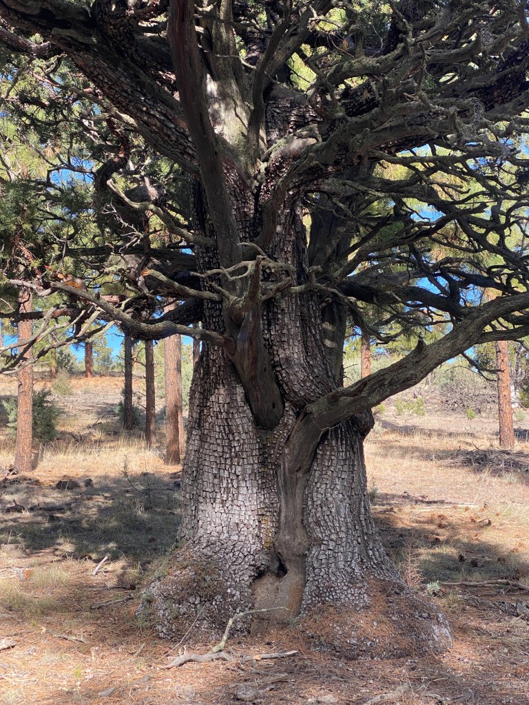
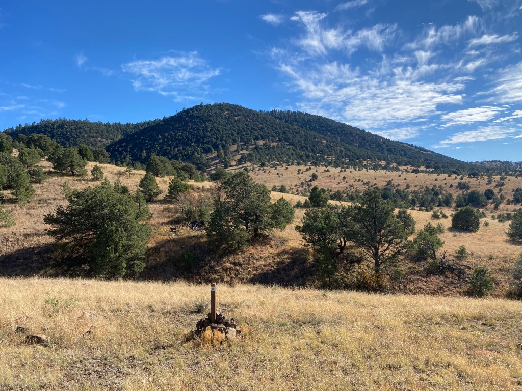
A quick five miles of walking brought us to a random water spigot, fed from a well on an 80 acre property that was for sale. Included with the property were piles of junk, a smashed port-a-potty, and an elk tag! As we climbed in elevation through the Apache National Forest, I admired the occasional alligator juniper with their scaly bark. Top Shelf and I chatted away and soon we’d reached the top of our climb, Mangas Mountain, a 9,600 foot peak with a lookout tower. We ate lunch before we began the descent.
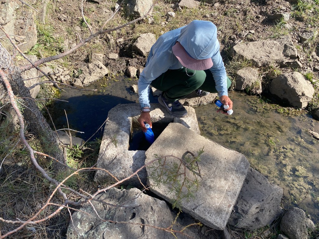
Mid-afternoon, we got water from a cement cistern in a cow field. The first cistern that I peered into had a long drop to the water, but FarOut comments directed us to a smaller one where the water was nearly level with the opening. From there, we walked a series of dirt roads that got narrower and rockier. We came across three hunters in an ATV that had never heard of the CDT or really any New Mexico landmark mentioned by Top Shelf. We decided that they were from Texas.
When we were ~1.7 miles from Highway 12, the sun dropped below the horizon. On either side of a large alligator juniper, we found a couple patches of mostly rock free ground. Then I had to remember how to set up Quick Draw’s tent as it’d been over five days since I last used it. Once inside, I ate dinner and figured out how to arrange my gear in the still new space. I also dug an evening – what?! – cat hole. My bowels were thrown off by town food.
Day 127
Upon waking, my phone said it was only 5 am yet I saw a red light on in Top Shelf’s tent. I went to dig a cat hole (yay, my body was back on track!) and when I returned to my tent I was alert so I continued my morning routine. As I finished breakfast and begin to pack up, I was confused to see the sky lighten so early. Then Top Shelf reminded me of the fall time change.
From our campsite, it was less than three miles to Aragon Tank. The tank was gigantic, maybe 6 feet tall and 25 feet in diameter, brimming with good water. It had tiny fish and a flock of robins sat on the adjacent fence posts. Luckily the tank was in direct sunlight so we basked as we filtered water. It was a long stop as we collected three liters apiece then realized that we had cell service and sent a few texts.
The trail crossed flat range land, climbed a short hill, and entered the Gila National Forest. We began a long ascent to Wagontongue Mountain. My pack felt heavy with water and food, though I realized I hadn’t carried more than a day’s worth of food for a week before entering this section with seven days of food; quite the difference. Half-way up, I caught a second wind and hiked along full of energy. We stopped on top for lunch, though Top Shelf was nauseous and only ate crackers.
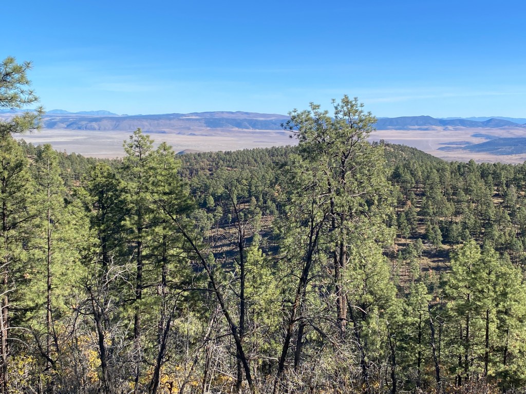
Shortly after lunch, a canyon alternate split from the trail, allowing access to a series of water tanks. We stayed on the official CDT, though it was apparent most hikers did not as the trail became fainter and was sometimes obscured by branches and pine cones. I did occasional trail clearing, thinking of Quick Draw, who had done so on a daily basis when we hiked together. I was happy we chose the high route, it offered a great view across hills cloaked in ponderosa forest to the distant San Agustin Plain.
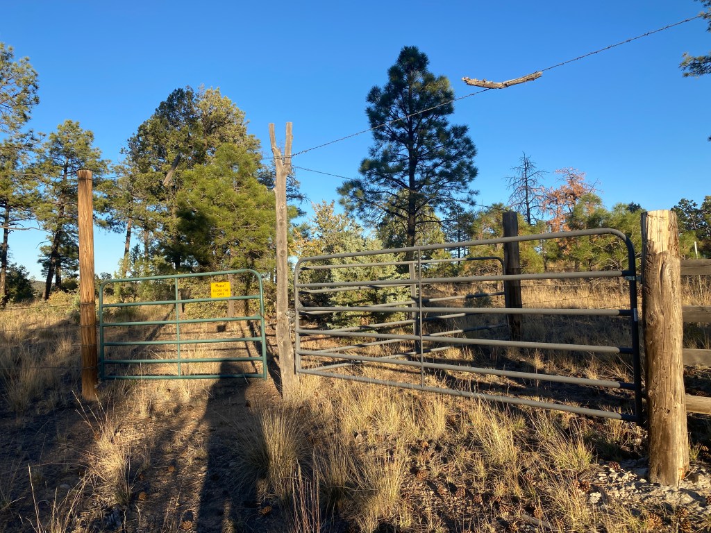
After passing through the day’s eighth gate, of multiple closure types, the trail became well trodden. Our original plan was to camp at the water cache that we hid on our last day with Quick Draw. However, Top Shelf’s nausea continued and she felt fatigued, likely side effects of the Giardia meds. We stopped at a large cattle pond so that I could fill a liter of water then camped at a nearby road crossing. As we ate dinner, a nearly full moon shone down and lit our tents.
Day 128
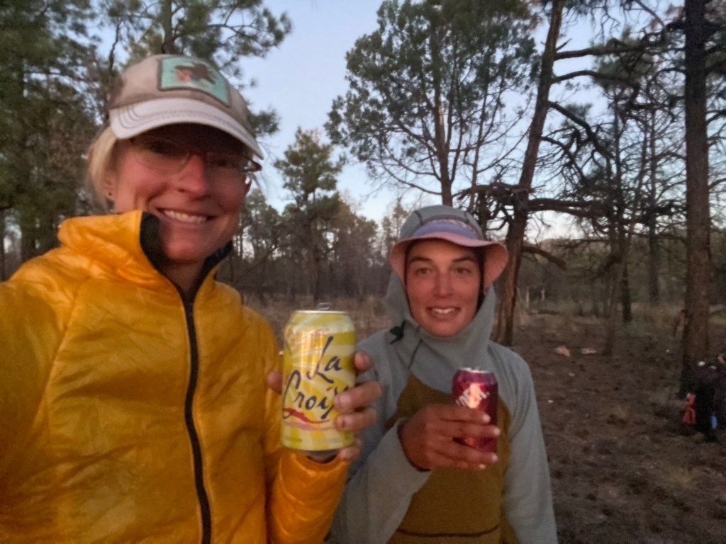
From our campsite, we ascended through ponderosa forest with rocky outcroppings and occasional oak trees. The oak leaves were yellow-orange and reminded me that it was fall. We hiked the ridge-line up and down a series of hills, ascending 1,600 ft. in five miles. On the last hilltop, I looked upon a familiar road intersection. Soon we were at the cache that we helped Quick Draw stash under a pile of branches. It was all still there. I drank a lemon iced tea, a Limoncello La Croix, and water before I filled three liters to carry. Thanks Quick Draw!! It felt great to rehydrate as I only had ~1/2 liter of water left upon waking. I also flushed my filter and cleaned my mouth guard.
The cache was at the Gila alternate northern intersection. Though Top Shelf and I planned to take the official CDT, I suggested that we take the alternate for 10 miles to a solar well then cut over to the red line as they mostly paralleled one another to that point. The goal being to cut our next water carry from 33 to 23 miles. She agreed so we set out along the alternate, which at that point was all hard-packed, wide dirt roads. There was a small amount of traffic, mostly hunters. The miles passed quickly as we chatted while hiking side-by-side.
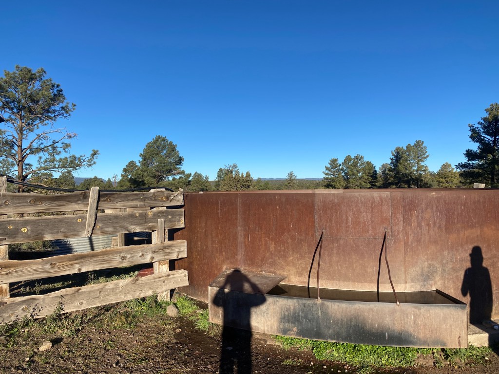
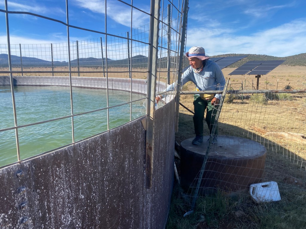
It was easy to spot the well from a distance as it was surrounded by a large group of cattle. They scattered as we approached the area. Two solar panels powered a pump and a large amount of clear water flowed from a pipe into the larger circular tank. I filtered the water just to be safe. Top Shelf did not and we joked about how you couldn’t get Giardia if you already had it.
A couple miles later, we rejoined the CDT, though one could hardly tell. We navigated via CDT blazes, candle blazes, and cairns. The tread appeared rarely and only faintly, not enough hikers travel the section to maintain a well-defined footpath. Top Shelf said the conditions were similar to routes she has done and which I aspire to do. Also, after I adjusted to cross country travel – and the occasional stop to dig grass seed out of my socks – I enjoyed the solitude and unexplored feel of the terrain. Sunset was a brilliant pink! We camped on pine duff at the base of ponderosa trees.
Day 129
The day began with a gradual climb to a pass. There was an impressive amount of blazing on the section for how few people use it. I enjoyed the game of hunting for trail markers. Top Shelf and I discussed how the lack of tread and limited water info seem to intimidate the average thru-hiker. Though if more thru-hikers did the section, it would solve both issues, plus reduce the amount of impact on the overused Middle Fork Gila River area.
Slightly before noon, an old two-track road brought us to Coyote Canyon Road. Near the fourth cairn from the road, we found a water cache under a juniper. The four sealed gallons were in a shady spot and well secured. We decided to eat lunch there. Our original plan was to get water at Graveyard Well in 5ish miles. However, it was a 1.8 mile out and back and, between route finding and cross country travel, we were moving slower than usual. I proposed that we take enough water from the cache to walk past the well to Batton Pond. Top Shelf liked the plan.
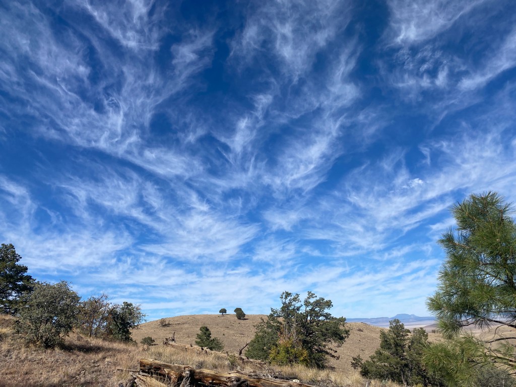
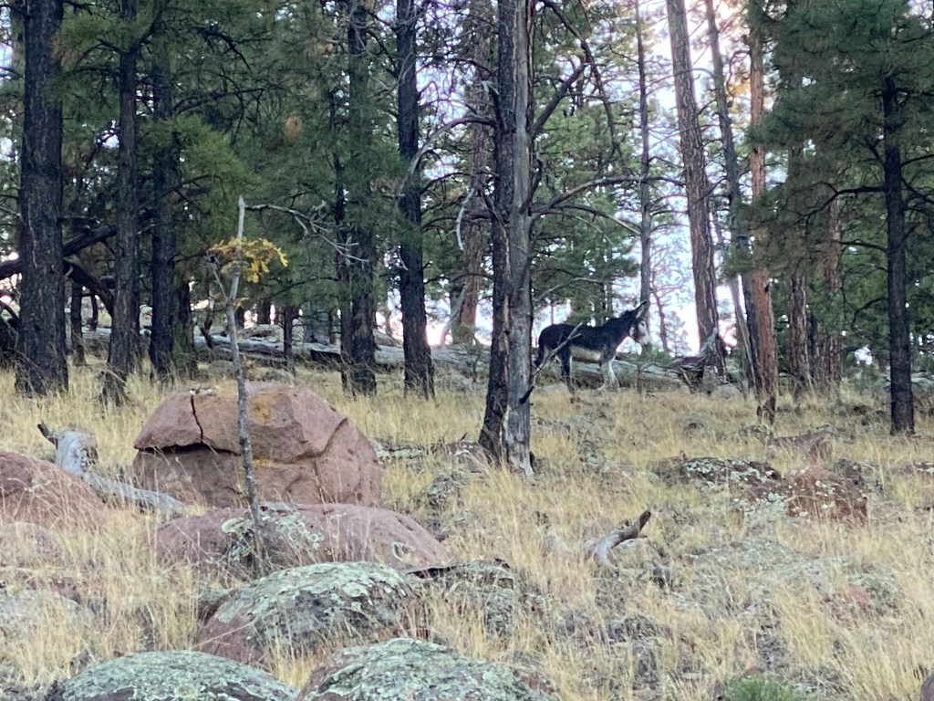
All afternoon there were fantastic vistas! I enjoyed the browns and greens of the desert contrasted with the blue sky filled with wispy clouds. At the well junction, we merged onto a dirt road and stayed there for the rest of the day. It was mostly a gradual, pleasant walk with a couple rocky, AT steep climbs. We passed a couple cow ponds and both saw a cute, wild burrow that had a mask-like white face.
As dusk fell, we reached Batton Pond. It was very large and only slightly murky, three edges lined with cow hoof prints and the fourth with a several foot tall rock ledge. I filtered 1.5 liters then grabbed three liters of dirty water. A four cow group waited impatiently for us to leave, then gave up and circled to the far shore to drink. We put on our headlamps and fleece layers before we headed south to find a flat site. In camp, the yellow-brown water filtered clear and tasted fine. Top Shelf and I chatted from inside our tents as we ate dinner and performed evening routines.
Day 130
I woke to find my water bottles half frozen and frost on the tent wall near my feet. After I dug my customary cat hole, I slipped my lower half into my sleeping bag to eat my cold-soaked oats, which were slightly icy; a first on this trail. Top Shelf and I chatted back & forth, keeping one another apprised of how close we were to tent take down, which we synchronized. I kept my puffy on and happily the trail immediately began to ascend. The day warmed quickly as we climbed five miles to a wide ridge just below Pelona Mountain. We ate a snack and admired the view.
From the mountain summit, it was 17 miles to Hwy 163. We went through a gate and switch-backed down a hill with evidence of a past burn. Then we followed a fence line past two dead cows. Grass seed leapt into my socks & shoes and occasionally I stopped to remove the ones that jabbed my ankles. We reached the desert plain, which was flat with a gentle rise now and then. Top Shelf & I saw prong horn, mule deer, a rabbit, and a lizard. Most of the time we walked side by side as there was little tread to follow. Fence lines were the preferred route with snippets of dirt road. Cairns were the only trail markers. We passed several cow tanks that contained water, yet we both had enough from last night’s pond.
We discussed our next hikes; hers the Desert Trail and mine the Grand Enchantment Trail. Top Shelf did the latter and mentioned how her hiking buddy Homework got Giardia and had his medication delivered to an abandoned freezer in a ghost town. In January & February, we’ll both be in Washington state. Top Shelf as a nanny in Seattle and myself at my Vancouver pet sit.
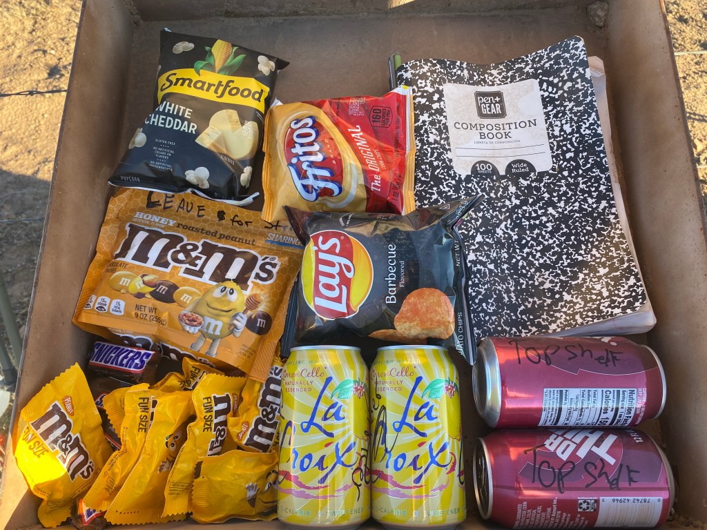
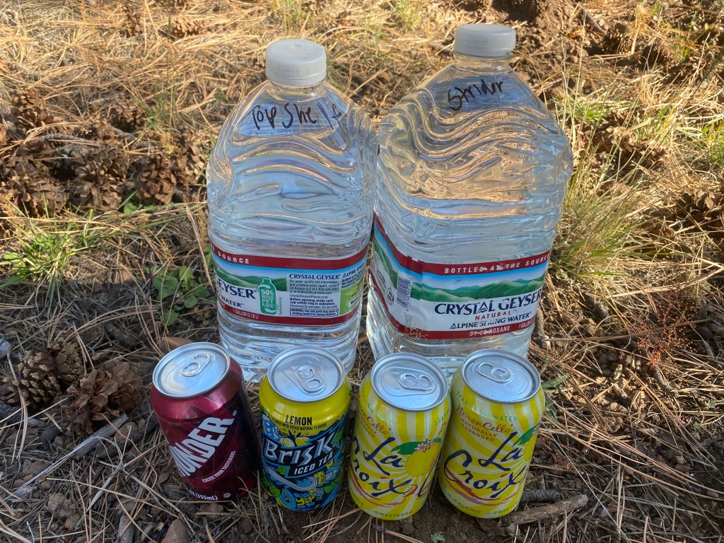
With excitement, we reached the Hwy 163 cache and found water, sodas, and PowerAde. Inside the trail register, there was a pouch of Honey Roasted M&Ms labeled “Leave for Strider”, drinks with each of our names, chips, and candy. Awhh Quick Draw! What a guy for leaving us such fabulous trail magic in a remote location! The log book had only two fall entries, neither sounding like thru-hikers. We sat next to the register, where we snacked and drank. Though we had over an hour of daylight left, we decided to camp in the spot to make the most of consuming our good fortune.
Day 131
With a 24.8 mile day ahead of us, we got up an hour early. Top Shelf started to pour three Dr. Thunders in a Smart Water bottle, yet once again most of our beverages were half frozen. She ended up holding a slushy can as we began to hike. My hand would be frozen! We assumed we were walking a dirt road for the first four miles; easy headlamp terrain. That was not the case and we ended up going 1.4 miles round trip in the wrong direction. It was actually a series of poles, the first few all knocked down, that we followed across a private property easement.
Shortly after sunrise, Top Shelf spotted a coyote. We watched it run off and become a silhouette against the blue sky. It watched us and then it howled. We heard answering howls from first one, then two directions. It was neat! I hear coyotes a lot at night, but I think that was the first time that I had seen one howl.
In the morning, there was a lot of route finding and climbing straight uphill as if we were on the AT. Then we got onto an old dirt road and followed it for most of the remaining day. It gave us a rest, not having to scan constantly for blazes or cairns. It also meant that we covered trail miles faster. Early on there were supposed to be a few gates, however we never found any of them. So when there were supposed to be five gates in the last five miles, we were skeptical. We acted amazed at each we found and, in fact, all of them did exist, including a unique, three way gate.
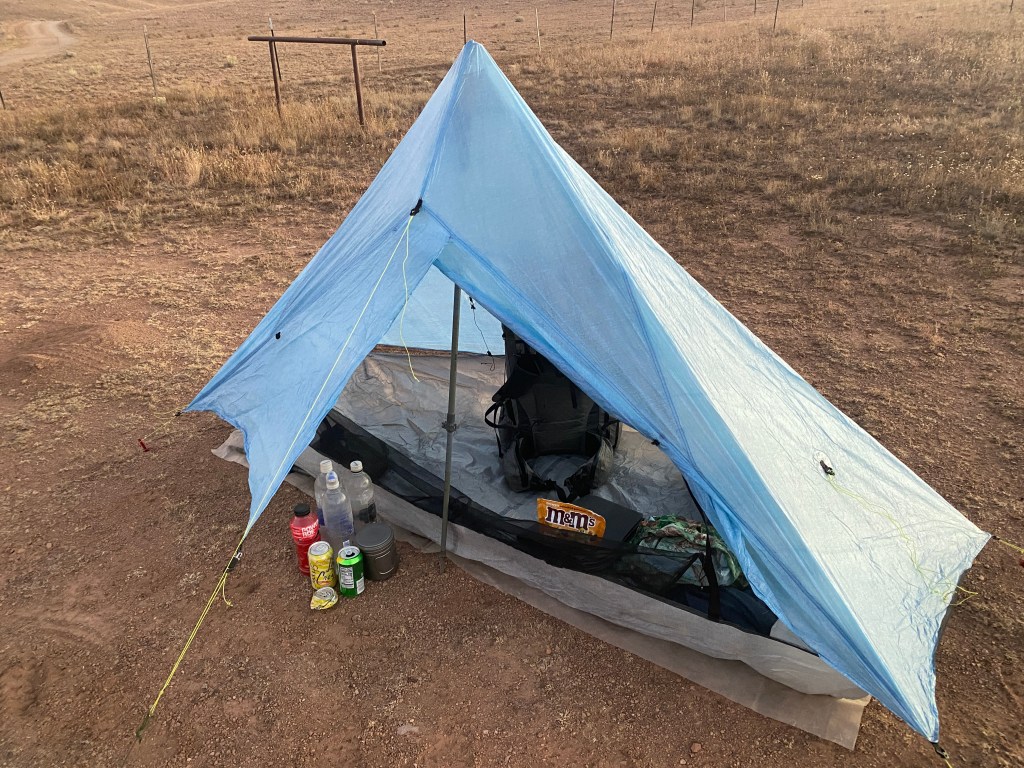
Just after sunset, we reached an intersection 0.7 miles from Hwy 59. We found our final Quick Draw cache: one liter of water, a La Croix, a Dr. Thunder. Since we found no water all day and didn’t plan to hitch until morning, it was greatly appreciated. We pitched our tents in a large site with a ponderosa tree at its center. We’d done over 26 miles, our longest day together, and were ready to rest. Top Shelf felt 100% for the first time this section and ate a good dinner. I ate dinner plus lots of honey roasted M&Ms and went to sleep early.
Day 132
I slept well and woke refreshed! We took down our tents as the sun broached the horizon. Our tent site was a comfortable temperature overnight, however it was significantly colder at the Hwy 59 trailhead. Eventually the sun broke through the trees and we stood in its light. After we waited 76 minutes for a car to pass, Top Shelf peed (we joke that it manifests a vehicle or hunter). Sure enough, we heard engine noise and soon saw a pickup. The driver was a hunter headed to Winston. He stopped to make sure we were okay and then gave us a ride.
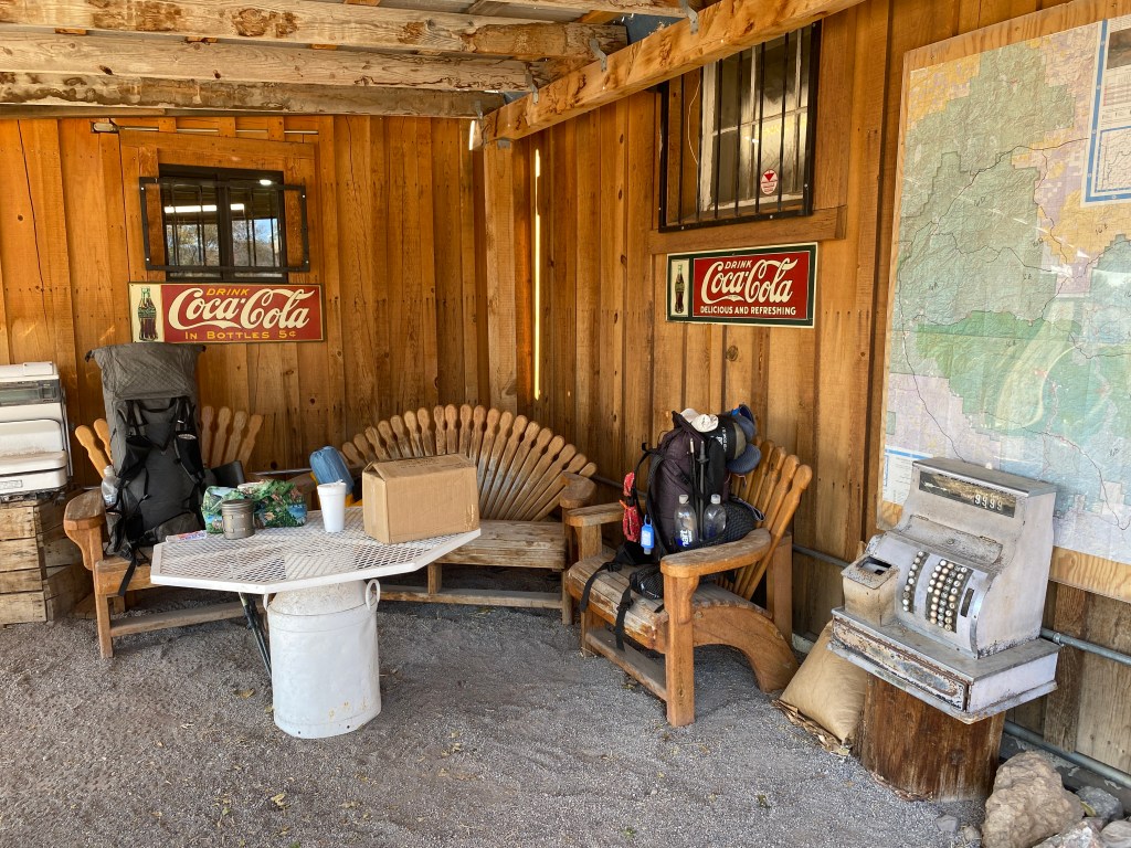
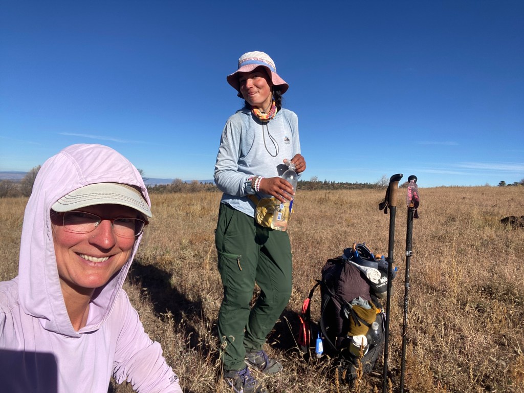
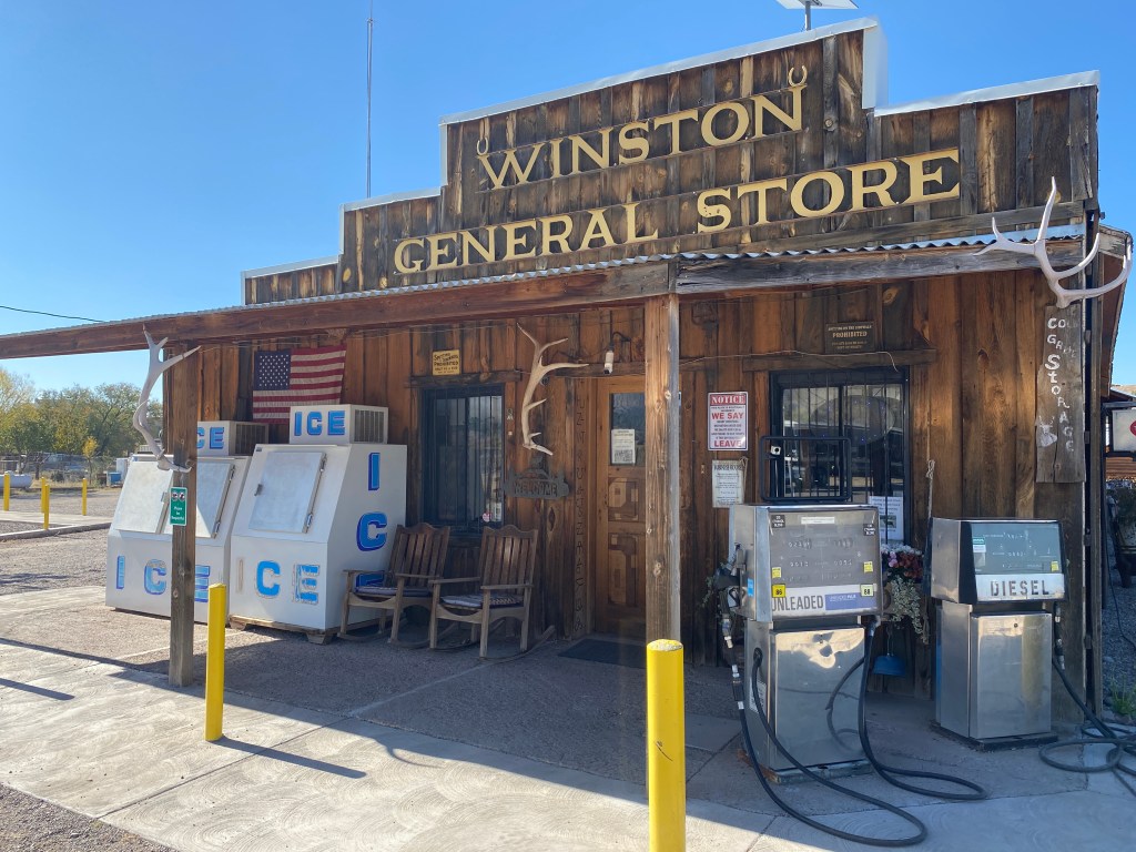
Our hunter pal dropped us at the Winston General Store. A cute, outdoor area with a table & chairs became our hangout. We each got coffee, a banana, and other snacks. After we ate, I went to the post office and Top Shelf returned to the store. We each sorted and organized our resupply. Using my box, she mailed home several extra items. I went back inside the store for more snacks. We walked to the south end of town to see if Crossbow Coffee was open; it was closed for the season.
After we went back inside the store for ice cream treats, I asked one of the friendly ladies about WiFi. She told me the church across the street had open Starlink. I scoped it out then Top Shelf and I went there to use it and hang out in soft cushioned chairs. She returned to the store for more food and I hung out longer. With a fully charged power bank, I met her back at the store so we could hitch out.
All day a stream of hunters stopped in town, apparently deer rifle season opened the next day. One store lady warned about catching a ride with them, she said many do more drinking than hunting. Luckily Doug, an elderly geologist headed to Socorro for a mineral symposium, picked us up. He was only going partway up Hwy 59 (the second leg of the journey) to check out a tin deposit, but ended up taking us all the way to the trailhead after we all got to chatting. He was from Denver and enjoyed the outdoors. Doug even hiked the 14er Uncompahgre in September. After he dropped us off, Top Shelf and I hiked three miles then camped amongst ponderosa trees.

Leave a comment