Intro
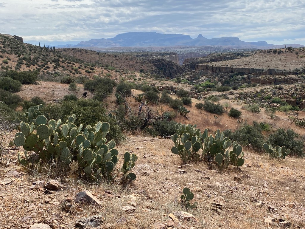
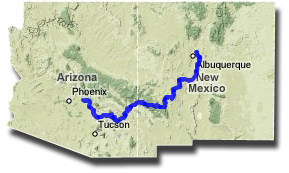
The Grand Enchantment Trail (GET) is a route created by Brett Tucker. It travels 770 miles from Phoenix to Albuquerque, traversing various trails, 2WD and 4WD roads, and 85 cross country miles. The route passes 170+ potential water sources and crosses ten 10,000+ ft. peaks. It also explores the Sonoran and Chihuahuan deserts, the two wettest in North America. There are no official guides or apps, however Brett provides a wealth of information: over 1,000 GPS waypoints with detailed notes, topo maps, town guides & maps, a water spreadsheet.
Having backpacked over 9,000 thru-hiking miles and the little-used Black Mountain portion of the CDT, I felt ready to take on a route. My gear list was similar to what I had on the AZT except for using my Durston pack and carrying more battery bank power. Per usual, I made most of my food, ending up with six resupply boxes and a planned town resupply in Safford. Four of the boxes I mailed, the other two I gave to a good friend who will mail them when I provide notice.
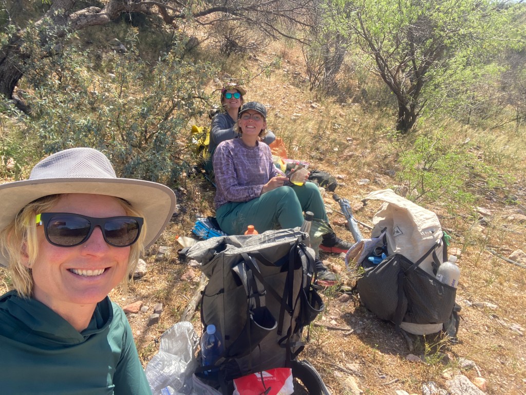
My hiking buddies are Bird, who I met on the CDT, and Beans, who is a friend of hers. Bird and I had a couple planning calls. We planned to set out together from the trailhead on the outskirts of Phoenix. However, they wanted to start a week earlier than my original plan and, after reflection, I wanted to spend that week with my Phoenix friends. So I decided to meet them in Mammoth one week into the trail. We’ll head eastbound to Albuquerque. At the end of the trail, I’ll return to Mammoth to finish those first 120 miles westbound and solo.
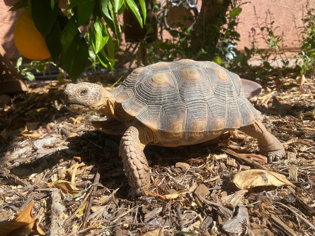
When I finished my winter pet-sitting job, I flew to Phoenix and stayed with friends. We had fun: playing board games, eating yummy meals, identifying butterflies and lizards at Hoyt Arboretum, and attending a banana ball game. They had a new dog who was anxious, yet a real sweetie. I helped them train him around new people. And they had a desert tortoise, a rescue who had lived with other humans for a decade, in the backyard. I fed him hibiscus leaves and stroked his head. He had an earthen den for hibernating during the winter months.
Day 1
Leaving at 5 am, Mel gave me a ride to the Greyhound bus station and we chatted merrily the entire way. The traffic was light so we had extra time and swung by McDonald’s to grab me coffee. Back at the bus station, we said goodbye and I went inside. As I went to sit, I realized that I left my phone in a car door pocket. It’s revelatory, how much I depend on my phone; it held my bus ticket, contacts (I knew two useless phone numbers), navigation apps, entertainment, etc. I felt the odds of Mel noticing the phone were low. On the bright side, I did know my location and how to return to my friend’s house, which I did via the light rail and bus. Mel had found my phone, attempted to deliver it, worried, and was happy to see me when I showed up at the house.
Since I missed my Greyhound bus, I briefly debated taking the next one from Tempe, however it wasn’t until noon. Luckily, Lyft prices had plummeted so I took one straight to Mammoth. (My original plan being to bus to Tucson then Lyft to Mammoth.) I even beat Bird and Beans to the town as they had trouble getting a hitch in. We connected in front of the Dollar General. They resupplied in the store while I watched our gear. Then the three of us went to the library.
At the library, we charged electronic devices and planned our route to Safford. We all had OnX Backcountry and had pre-loaded Brett’s provided waypoints and track. Unfortunately we were unable to secure permits to traverse Aravaipa Canyon, purportedly stunning and the only area along the trail which required a permit. We decided to take the north bypass as it looked more interesting than the south bypass. Going day by day, Bird examined the elevation gain and feasible camp areas. Beans and I reviewed the water spreadsheet and data point guide, informing Bird. Though not many people thru-hike the GET, two guys are ahead of us and updating the public water spreadsheet. Bird came up with an eight day itinerary to Safford, which she shared to our phones via the OnX Backcountry app. We each had seven days of food so our itinerary included a stop in Klondyke to get food for the additional day.
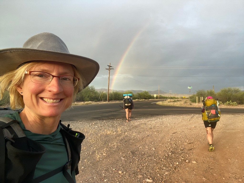
We left the library and stopped for dinner at a cute, local Mexican restaurant. Then we went to the Circle K and filled our water bottles. It didn’t take long, standing by the highway, to get a ride from a nice lady named Betty. She took us nine miles north and let us out at Aravaipa Canyon road. There was a quick rain fall while we were in the car. As we walked along the paved road, a beautiful rainbow, faintly double, decorated the sky. A lovely way to begin the journey!
The paved road segment was short, followed by dirt roads. We had five-ish miles to camp and did half in the moonlight, not needing headlamps. We made camp on high ground overlooking a wash with a potential water source. It was a warm evening and all three of us decided to cowboy camp. There were dark clouds in the sky, however the Garmin reported zero chance of rain. It was wrong because a short time later we felt rain drops and hurriedly set up our tents. As I fell asleep, from the direction of the wash, I heard a creature moving and making unfamiliar noises; I wondered at its identity.
Day 2
On my way to dig a cat-hole, I discovered a pipe with an upward spout, very close to our camp. We topped off our bottles to three liters apiece. As we began our hike and passed the spout, I noticed a crack in the pipe and leaking water. We found a way to stop the leak by turning a couple valves. Down in the wash, there was a small, shallow pool of water with a tiny amount of flow.
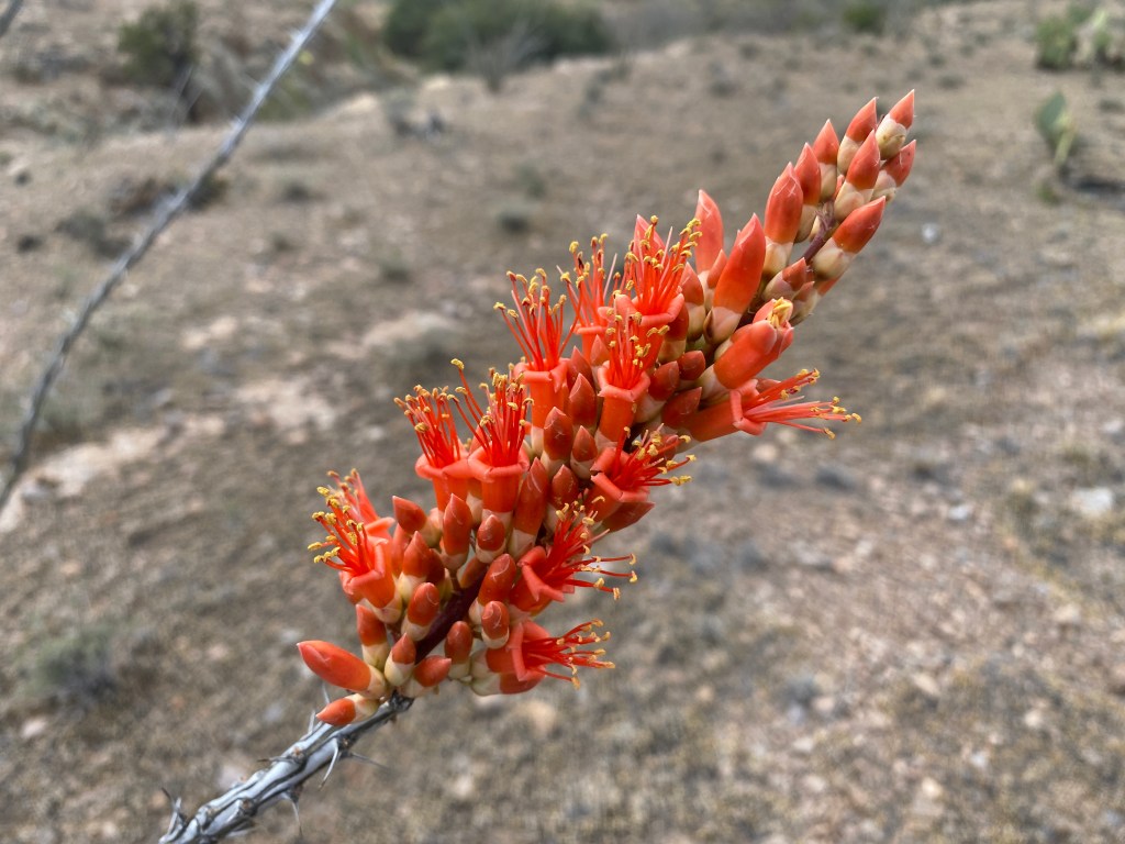
Our morning route led us along a faint, two-track dirt road that slowly ascended. At one point, from under a bush, a large Western Diamondback snake warned us with its rattle. My first snake of the trail, yay! The Ocotillo were tipped with beautiful red blooms. The sky was overcast and the temperature perfect for a steady climb. Eventually a medium rainfall began and we used our Gossamer Gear sun umbrellas for protection. They worked well, though after a time we stopped to put on rain jackets. Our feet grew heavy from the mud of the road. The other gals, having walked a week through a heat wave, truly appreciated the desert rain.
When the rain passed, the air filled with birdsong, a multitude celebrating the moisture. We reached an upright, rectangular metal tank, the wind flinging water from one overfull corner onto the ground below. We took a leisurely break. I climbed the tank’s ladder and scooped a liter of clear water to drink. I also ate about 2/3 of my lunch, my body was hungry from its morning exertions!
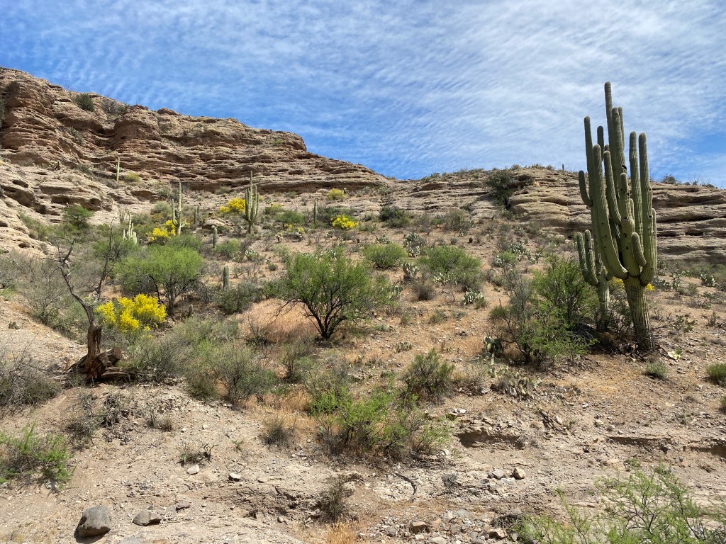
Shortly after the tank, we dropped into an open canyon with layered sandstone walls, saguaro dotted with bird homes, and brilliant yellow brush. Beans spotted a lizard and I identified it as a Regal Horned lizard. I was excited to observe a new variety, having never seen one with its spiky ruff.

A bit past noon, we took a side trip to an old homestead built into a natural rocky crevice. One end, where the rock curved down to meet the ground, looked like a hobbit’s home. Inside we found a few pictographs etched into the soot-covered, stone roof. At 2 pm, we took a second side trip, walking across desert mesa to a viewpoint of Aravaipa Canyon’s upper reaches. While Bird and Beans ate their lunch, I finished off mine.
The afternoon took us along dirt roads followed by a couple mile bushwhack down into and out of Horse Camp Canyon, where the trickiest part was picking our way through a forest of Prickly Pear cactus. We passed a series of giant stock ponds and decided to camp at the third one, Double Tank. It had a nicer shoreline than the previous tank, which meant easier water scooping access. We gathered water and set up camp as darkness fell. The full moon was beautiful as it hung low in the sky. Birds and Beans cowboy camped while I set up my tent. I could feel moisture building in the air and knew that I would sleep better inside. My first full day and we covered with 4,000+ ft. gain.
Day 3
Early in the morning, I was awake for a long time and heard a bird making continuous, varied noises. Later Beans identified it as a Mockingbird, which made sense. She and Bird woke up to damp sleeping bags while I only had a small amount of condensation on the inside of my tent. We were slow to get out of camp and started the day with an easy road walk. On a rise, I spotted a small wild horse herd that included a tiny foal. There were also cows and a couple white-tailed deer
As the morning progressed, we began a large loop – to avoid private ranch roads – by following a wash east along Horse Canyon. It ended near a cattle corral and we bushwhacked up a hillside, attempting to find a dirt road. Instead we found a narrow wash which gradually grew steeper. It got sketchy near its terminus at the base of short, crumbly sandstone outcroppings. The three of us made a good team, together working out a safe route across the loose terrain. We scrambled out atop a flat ridge and spied the road we had tried to find earlier. We took it to a circular tank with a solar power inlet pipe. There we ate an early lunch and spread damp gear to dry in the sunlight.
We chatted a lot as we walked along a really nice, dirt road. I learned more about my companions and them about me. Bird lived in Zambia, doing Peace Corp work, for a couple years and is applying to graduate schools to become a clinical therapist. Beans spends six months a year doing trail work in Rocky Mountain National Park (RMNP). Like me, they have no permanent home. Over the winter they lived together in Tucson along with Bird’s boyfriend, who also works seasonally in RMNP.
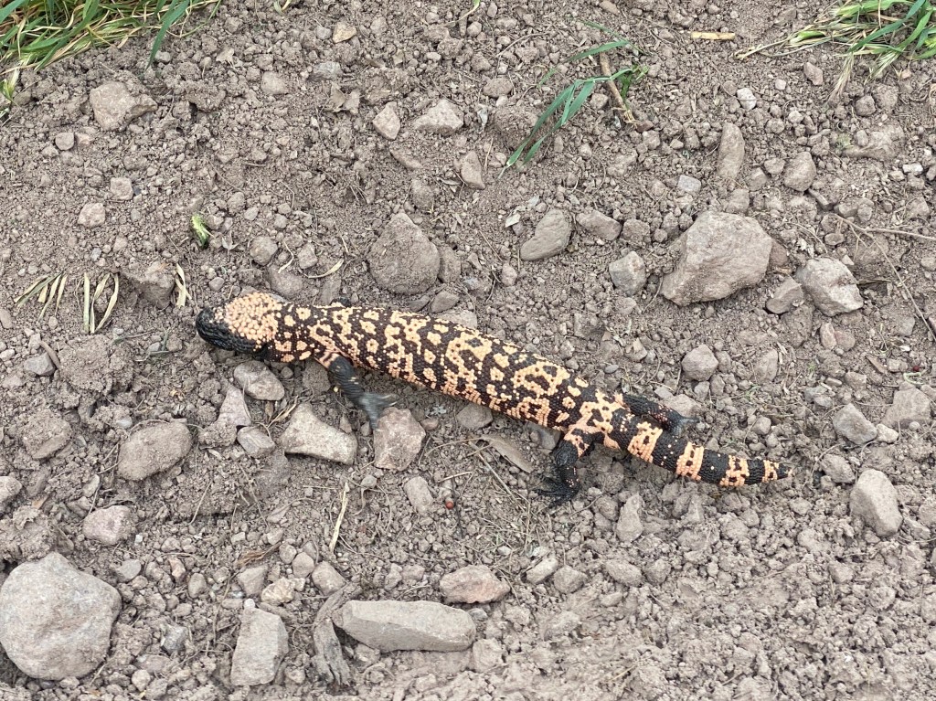
Shortly after the eastern Aravaipa TH, we were walking along the canyon, wide and tree lined, when I spotted what I thought was a Gila Monster. I eagerly ran towards it and it was indeed a colorful Gila Monster, maybe a foot or so long. I was so excited! It was the critter I most wanted to see on this trail and it already happened! The lizard was not too concerned by my presence, it flicked its tongue a couple times then casually climbed the bank and slid over the lower wire of a fence and into the grass beyond.
We took a 2.5 mile detour into Klondyke, a tiny town with only a General Store and BLM office. We made it to the store just before closing and I entered to find three older folks eating dinner. They were all super nice, accurately guessed that we were GET hikers, and offered us $5 camping adjacent to the store. We’d been talking about ice cream for the last five miles so in addition to one-ish days of resupply we each got a Klondike bar. Having consumed our ice cream, we set up tents and plugged devices into our site’s outlet. The sky turned a brilliant pink as the sun set. We’d done a 22 mile day.

Leave a comment