Day 4
I woke early and had trouble falling back asleep, partly due to being cold. It was better after I put my Senchi top on over my tank top, however, I find the quilt drafty as cold air leaks in when I roll from side to side. Determined to sleep warm, I used the store’s WiFi to go online and order a sleeping bag liner to Safford.
After retracing our detour into town, we did a short bushwhack to a dirt road that rose gradually along the crest of a ridge. There were wrinkly hills to the right and the few buildings of Klondyke in the distance. After several miles, we reached a gate and took a well-defined trail along the side of the trail to Laurel Canyon. There were pools of water in the wash and we stopped for a snack break and bottle refill. We took a longer break than intended because it was a lovely spot.
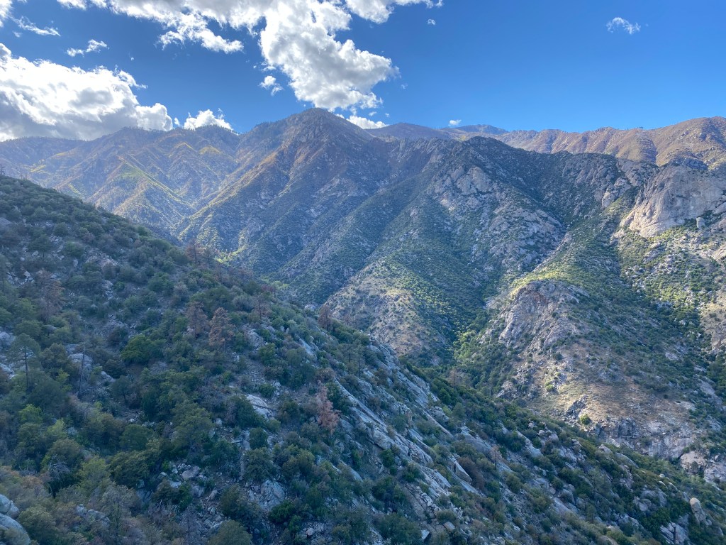
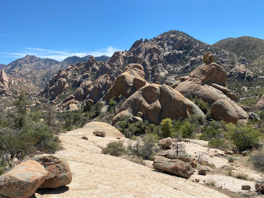
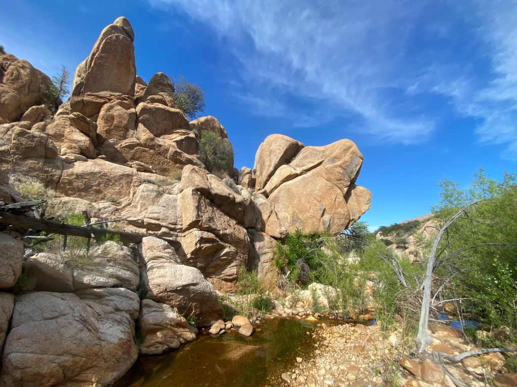
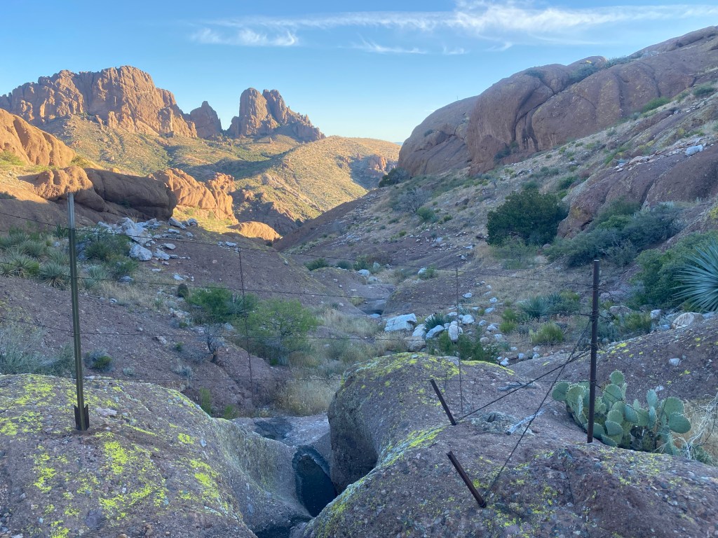
For a time, the well-defined trail continued along the wash and across hillsides. Then we got into an old burn area where burnt limbs and growth occasionally masked the trail and we constantly lost and regained it. We took turns navigating, it saved battery power to have only one person using the app, though Bird has a GPS watch that buzzes if we get off track, quite helpful. Eventually we made our way into Holdout Canyon, which featured stunning lumps of rock. Navigation along the canyon continued to be difficult, we constantly lost the trail, yet the views were worth it. I found a beautiful quartz crystal.
All three of our stomachs rumbled in synch so we stopped by some pools in the canyon’s bottom and ate a quick lunch. One hour later, Bird spotted the tail end of a mountain lion. By the time she told us, it was gone. I eagerly looked around, hoping for a glimpse. I’d love to see a mountain lion in the wild, while with other people. Some time after, Bird realized she lost her sun umbrella. She hypothesized that it got torn from her pack by vegetation.
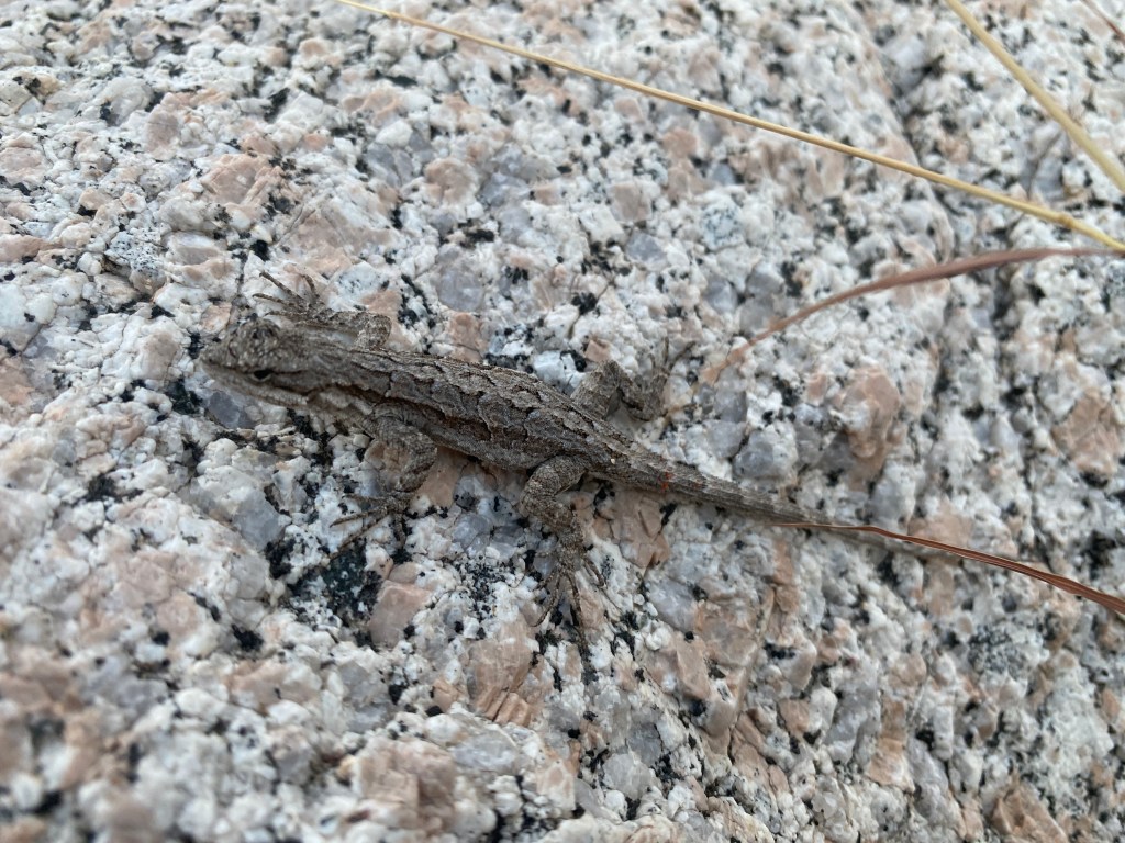
In the late afternoon, at my suggestion, we gathered water in case we had to dry camp. Directly after, we reached Black Canyon, which the track indicated had a great trail. It did not, luckily Bird was a powerhouse of navigation, leading us back and forth across the canyon’s flowing creek, avoiding cliffy portions and favoring sandy stretches. My head was foggy from lack of sleep and I was happy to follow. A lizard posed on a rock and Seek identified it as an Ornate Tree Lizard.
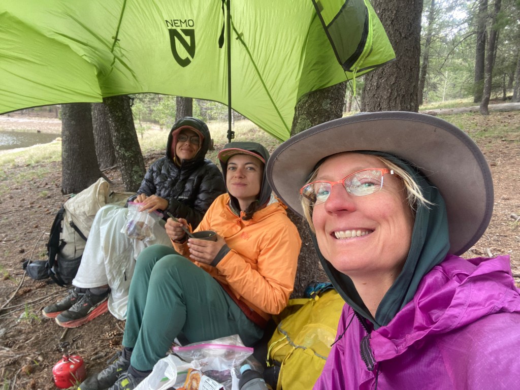
We broke out of the creek and entered a cross country section. My head cleared as I caught a second wind. We made our way past a reddish rock outcropping, under a barbed-wire fence, and up a steep hillside. As darkness fell, we used our headlamps to navigate to a saddle where we flattened grass and flowers to set up our sleep systems. The ladies sang me happy birthday then Bird gave me a hug and a surprise Reese’s 2-pack. We ate a group dinner and admired the stars. We were camped one mile into the cross country section, having completed an 18 mile, 4,000 ft. gain day. I was very tired.
Day 5
I got a good night’s rest and dug a morning cat-hole; my body is getting back into the backpacking routine! We set out from camp at 6:15 am and continued our cross country journey, climbing up and down a series of ridges. It was all to go around a private ranch, of which we caught a glimpse. What a tough environment to have a ranch! I enjoyed this fence built across a bedrock pour-off.
We finished the cross country section and found Cottonwood Mountain trail 66. For a mile or so we made good time, then the trail petered out. Beans navigated and after a time there were snippets of overgrown trail. Finally we reached Fourmile Canyon and stopped for lunch beside pools of water with a slight flow. We had covered six miles in as many hours.
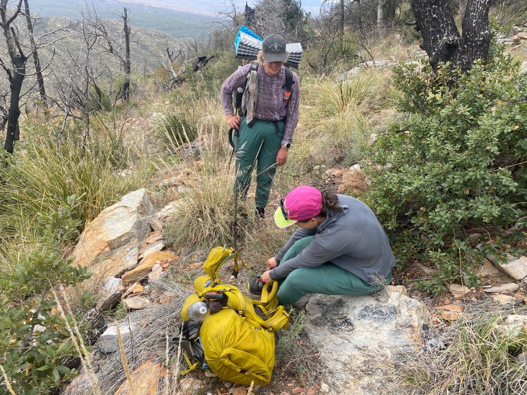
After lunch, we found a better trail and I led us up a ridge covered in Pinon pines toward Cottonwood Mountain. We stopped 200 ft. shy of the mountain’s summit and began a long descent. On the way, Beans felt a stab in her foot and stopped to remove a large spine that had gone completely through her shoe’s sole. She ended up pulling it out with her teeth and Bird suggested Thorn as a trail name. Her prior trail name was given in the first week of the hike and she’d been uncertain of it.
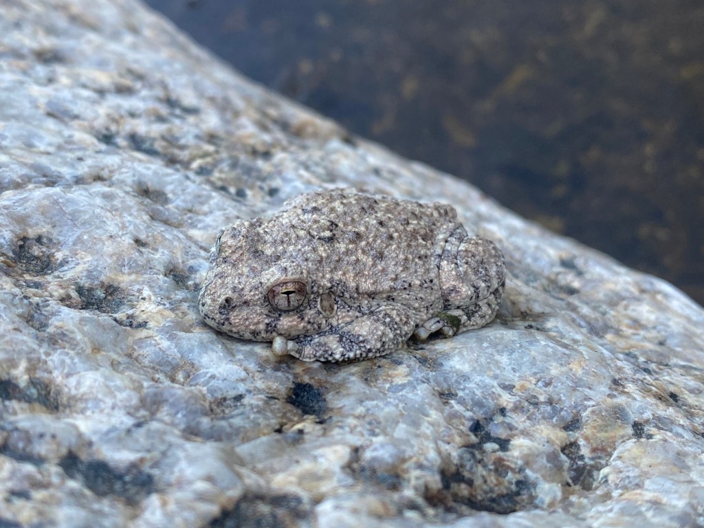
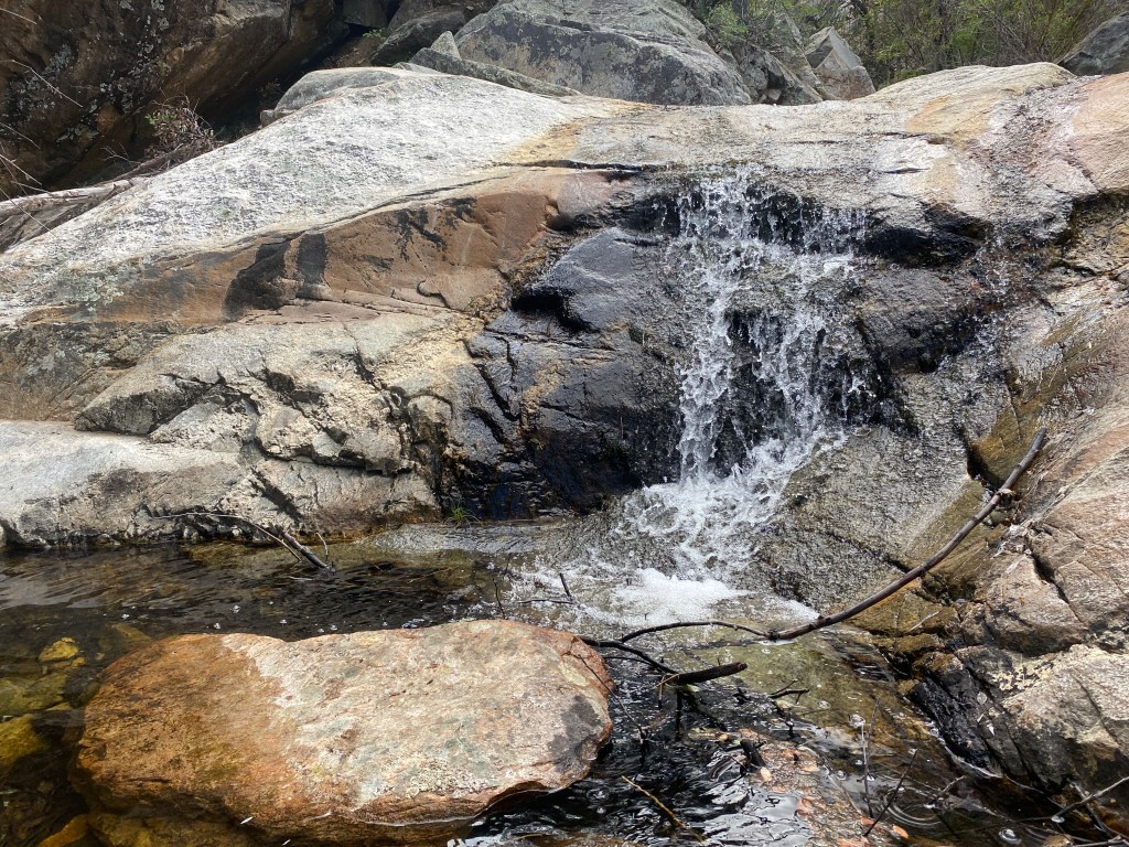
Shortly after the descent ended in Cottonwood Canyon, I took over navigation. The canyon’s thin stream was full of green algae and there was lots of cow activity. We transitioned from canyon to road to a two track. Eventually the two track brought us back to the drainage of Cottonwood Creek and we found a pour-off with great flow and water pools. We sat on flat rocks to gather water and I discovered Canyon Tree Frogs!! One hopped away from my foot and we noticed a couple others folded up and acting like rocks. They were adorable! We watched one shimmy up a water slicked rock face and later they made surprisingly loud croaking sounds. As we filtered water, Thorn realized she lost her spork.
We hiked another 3/4 mile and camped under Sycamore trees on the side of the creek drainage. It was a pleasant, soft spot and all three of us put up tents. From the largest tree, a bird called out and Thorn used Merlin to identify it as an Elf Owl. The three of us enjoyed cold soaked dinners.
Day 6
Both Bird and I slept intermittently, waking often. At least Thorn reported a solid night’s sleep. We were a little slow to get underway, but it was okay as we had a lot of easy road walking to start the day. It began once we left the wash through a cattle passage just south of a fancy, white vehicle gate. We all put on audiobooks, both Bird and I had ones that were due back to the library in a few days.
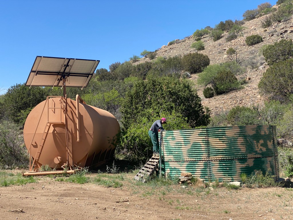
A mixture of two lane and two track dirt roads brought us to a large, metal, camo-colored tank fed from a solar array. On my approach, I spotted a muted yellow-green snake with black stripes, which Seek identified as an Eastern Patch-nosed snake. We took a snack break under a shade tree and used a pallet leaned against the tank to scoop water.
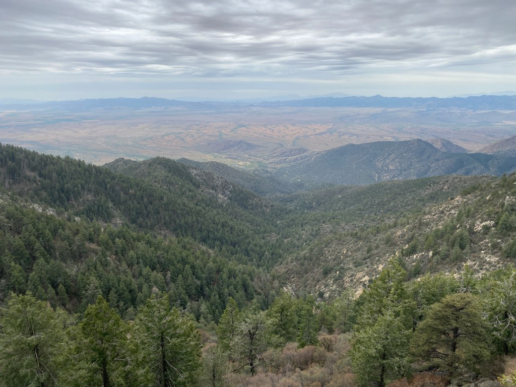
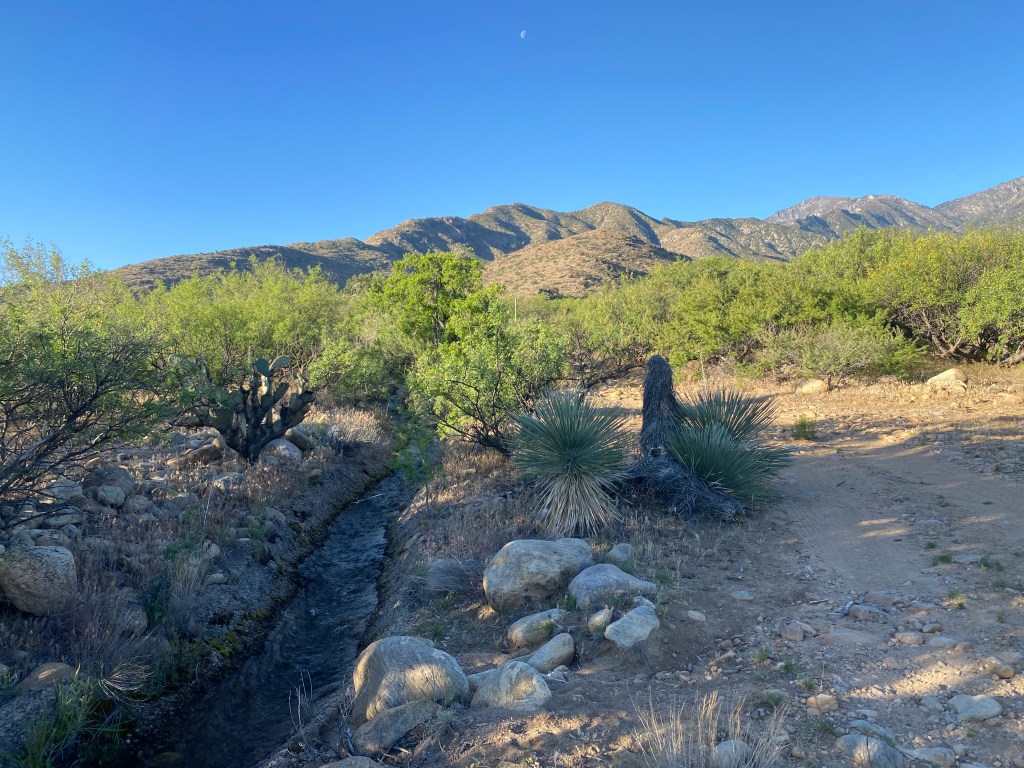
A brief road walk later, we started a cross- country section that ascended a long, though gradual ridge that was a delight to climb. Then came a short dip to an empty, circular cattle trough, where I gazed at the Santa Teresas mountains we’d left behind and the Pinaleños ahead. A stock trail took us steeply downward.
En route, Thorn spotted a lizard and it allowed me get close enough to identify it as a Greater Short-horned Lizard. At the base of the descent, near a swirl of intersecting roads, we lunched under shade trees. During our meal, two ATVs drove past and the occupants asked if we needed anything.
For two miles, we followed a trail beside a PVC waterline up Sawmill Canyon to a location that supposedly contained a spring (probably did because half-way along I spotted a flowing leak in the line). We then hiked up a series of drainages to reach a sunny Ponderosa Flat. Dry Lake Stock Tank contained murky, brown water that our amazing filters turned into slightly tea colored, fine tasting water. We’d intended to camp in the area, however it was only late afternoon so we decided to continue on to a camp-friendly saddle on the ridge of Blue Jay Peak.
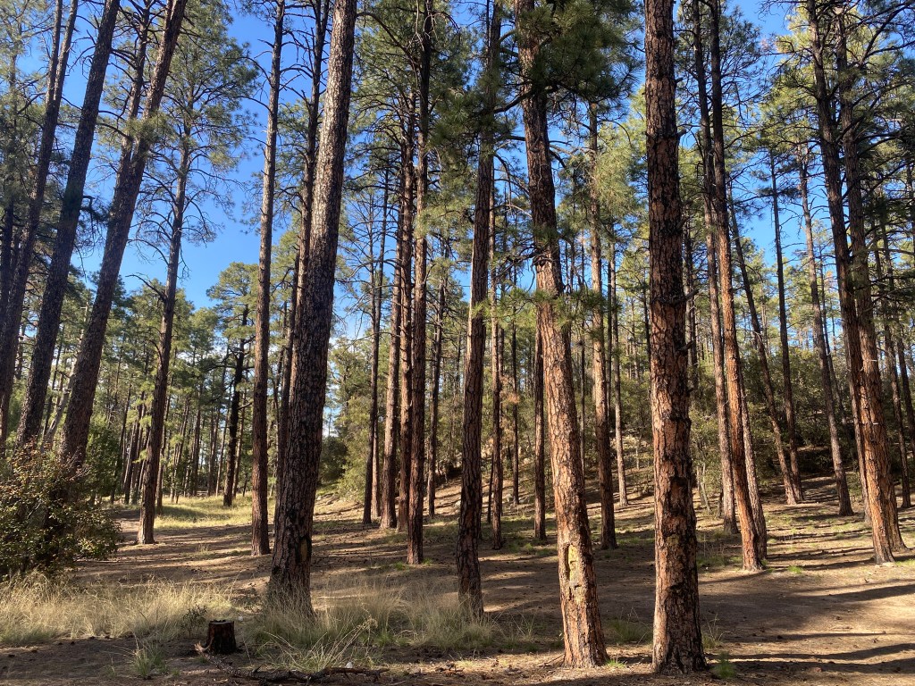
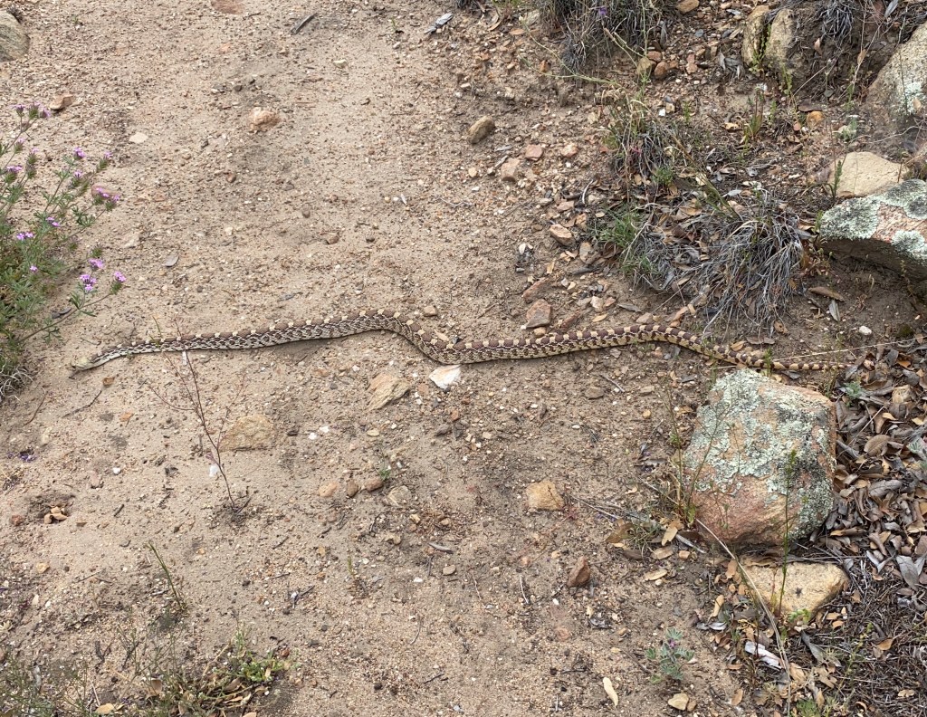
First, we hiked 1.7 miles along a forest road that climbed at a noticeable grade through mixed conifer forest. At the road’s second 180 degree turn, we transitioned onto the Blue Jay Ridge trail. It clung to the side of the mountain and offered fantastic views of pine colored hills and distant ridges in varying hues of blue. Thorn spotted a baby snake and Seek identified it as a Twin-spotted rattlesnake. I was excited to observe a new rattlesnake variety! The trail was in decent condition, we occasionally pushed through thick brush or climbed over downed trees. Near the top, I was surprised to see two prickly pear cacti.
When we gained the ridge, we could see the lights of Safford in the valley far below. We put on headlamps for the last quarter mile to our campsite. Bird and Thorn cowboy camped, while I erected my tent. I prefer being in my tent plus it offers a little more warmth and I was kinda cold last night at a much lower elevation. As we settled in, Bird told amusing stories of fox and porcupine encounters. We’d completed another 18 mile day with ~5,000 ft. gain.
Day 7
A breeze began to blow during the night, but I stayed warm wearing my tank top, puffy, and leggings under my sleeping quilt and slept reasonably well. When I returned from digging my cat-hole, the others had not yet stirred. Next time I peaked out of my tent, I saw headlamps, and soon after Thorn’s stove roared to life. Once on trail, we switch-backed up and down a couple humps along the ridge line. After a mile or so, the trail diverged from the ridge and ended at a road which made a broad curve 500 ft. below Blue Jay Peak.
Road walking made for easy conversation and I learned that Bird had guided paddling trips for a couple years in the boundary waters of Minnesota. She talked about portage and the fancy desserts they made on paddle trips. On a hunch, I checked the route and saw that we’d overshot our last turn by 0.6 miles. We backtracked and began a switchback filled descent that brought us to Taylor Pass, at 7,150 ft. From there, we ascended a long ridge toward Clark Peak, a 9,000 ft. summit. The ridge offered views of the surrounding Pinaleños Mountains. I enjoyed hiking amongst pines, yet also delighted in a cactus I found perched on a rocky ledge. After passing very close to Clark Peak, the trail brought us to a large sign and a dirt road. Thorn and I took a snack break and waited for Bird.
A light rain began as we walked the road. I put up my umbrella, happy the rain held off until I had a vegetation free space to use it. The others lamented the loss of their umbrellas, especially as the rain fell harder. It stopped shortly after we reached Riggs Lake. We claimed a spot amidst thick pine trees and Thorn tied her tent fly between four trees in case the rain started again. We ate lunch and filtered water. The lake had trash cans and an impressive dock, despite this it was oddly empty, perhaps the weather? Sitting left us chilled so we were happy to continue our hike.
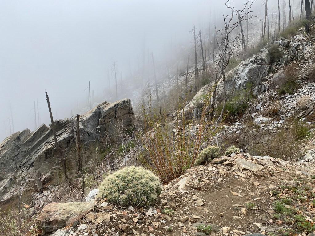
From Riggs Lake, we ascended back to the forest road, which rose gradually to Chesley Flat, a large meadow. Signage told us about a family who settled there, raised cows, and made cheese. Our plan involved hiking to the top of 10,030 ft. Webb Peak, then descending to Columbine Visitor Center and beginning the Ash Creek Bypass. However, there was a ton of fire downfall in the first tenth mile. We climbed over trunks & limbs, wove between thorn bushes, and didn’t see a trail. By group consensus, we gave up on visiting Webb Peak and made our way back to the meadow to immediately began the bypass. The bypass does a huge loop to avoid Ash Creek, the GET’s original route, where the trail was heavily damaged by the fire and subsequent flooding.
We hiked Swift Trail Road for the rest of the day. Briefly we stopped at the Visitor Center (closed for the season) to look at camping options. Between a chill wind and overcast sky, it was cold to stop, so we were soon back to chatting and hiking. The road wound along the edge of the mountains. At one point, sun beams broke through the clouds and lit us as we gazed at the desert valley far below. I voiced how it felt vaguely post-apocalyptic, these nice roads and facilities, and we hadn’t seen a single person all day.
Cunningham Campground looked inviting with its open bathrooms, bear boxes, and picnic tables. It was entirely deserted so we claimed the flattest spot. Knowing it would be a cold night and cautious of more rain, we all set up tents. I’d gotten too chilled (next time put on my puffy!) during the afternoon’s activities and it took me a long time, with all my layers on, to warm up in my tent.
Day 8
After eating oatmeal in my tent, I joined the others at the picnic table. I happily accepted when Thorn offered her stove to make hot water for coffee. Overnight she and I had stayed warm-ish, though occasional drafts of cold air didn’t make for the best sleep. As we walked across the campground and began our road walk, the three of us discussed quilts vs. sleeping bags. This time we saw a small amount of traffic, mostly state vehicles.
At the Shannon Trailhead, we departed the road and got onto the Arcadia Trail. It was a fantastic trail, well-maintained and mostly free of debris. A mist rose as we switch-backed upward, making the way look mysterious. After a 400 ft. climb, we began a long gradual descent with views of mountain ridges and the valley. When Safford came into view, I checked for and found cell service. I returned my audiobook and borrowed another, though I’d wait until town to download it. For the last section of trail and as we began a paved road walk, the three of us exchanged fantasy and outdoors book titles, ones we had enjoyed over the years.
We turned onto the Round the Mountain trail. I kept seeing vibrant pink flowers that turned out to be Desert Penstemon. A three foot long Gopher Snake had its head in the trail and I stopped for a picture. The others caught up and we all paused as it slowly slithered across the trail and into the vegetation. We took a long lunch break at Noon Creek, which was flowing strong with large pools of water. Thorn recalled that we had condensation dampened gear. The three of us spread it on boulder slabs where it dried quickly in the sun. Off to the side of a water flow, I spotted a single Canyon Tree Frog pretending to be a rock.
It was a 700 ft. climb from Noon Creek to the top of a ridge. Then came a 1,000 ft. descent via a multitude of switchbacks. The hills were a lovely mix of rocks and low lying shrubs. On the other side of flowing Marijilda Wash, I took over the lead from Thorn and the trail became more indistinct. We dropped down and back up to cross flowing Gibson Creek. The trail got rocky, my right foot developed one hot spot and both feet complained, it being a 20 mile day. A couple miles later, I reached Marijilda Picnic Grounds, our intended stopping point.
The area contained a couple fire rings and creek access plus a lot of gnats. We gathered water and retreated to a flat spot near the trail to camp.
Over the day’s course, we dropped 4500 ft. in elevation. It was so nice to sit in my tent and remove my dirty hiking clothes without needing to bundle up immediately. When I stepped out to do a couple tasks before bed, there were so many stars in an utterly clear and dark sky.
Day 9
Thorn and I slept well since the low was in the 50’s; Bird was too hot. We ate breakfast amidst our cluster of tents and were soon on the trail, eager for town food. After a mile, the rock-filled path veered away from the wash to follow concrete-lined Lebanon Ditch, which eventually terminated in a reservoir. We’d filled up on water the night before, unsure of the situation going into town. Mine tasted like cow, yet all the water was from the same source so it likely tasted like cow too. There were lots of lizards and over time the low lying shrubs gave way to sand and a multitude of Jeep/ ATV tracks. As we approached a paved road, both Bird and I saw what looked like another thru hiker, walking a perpendicular route into town.
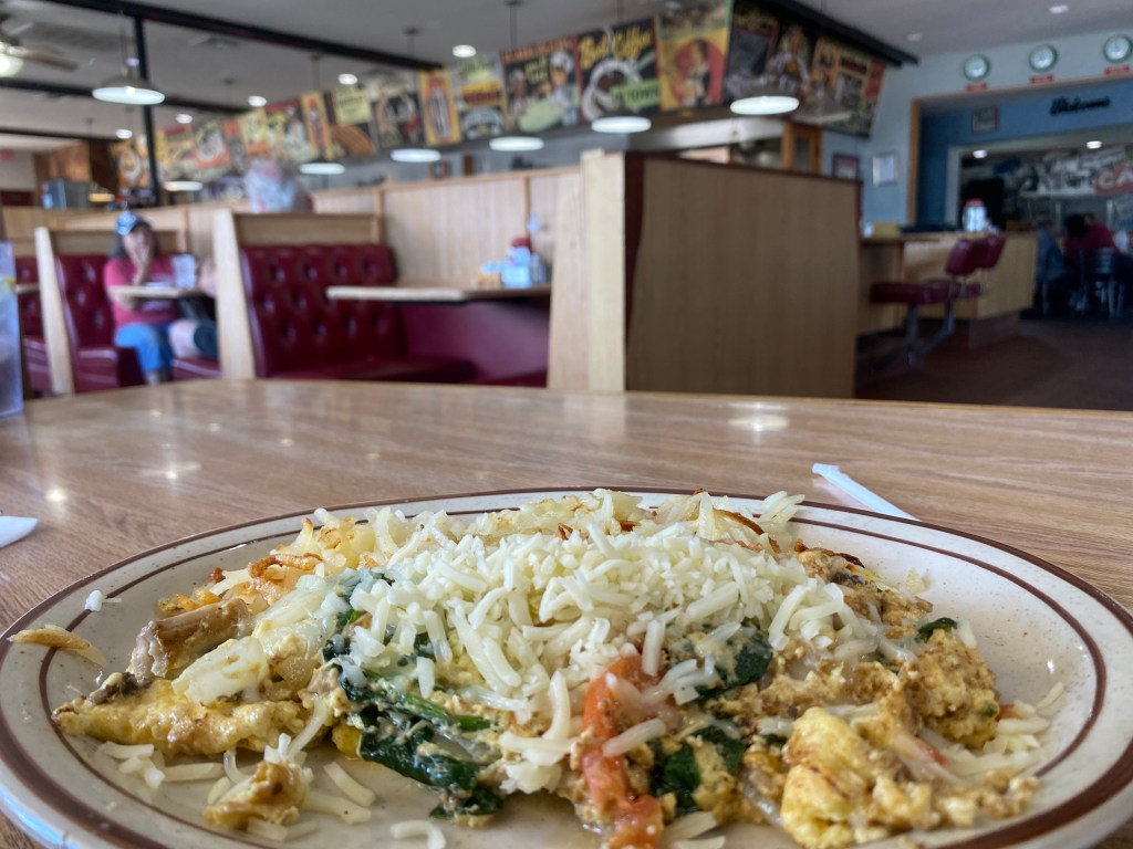
Our first stop in town was Walmart. We got snacks and other items, reconvening on the sidewalk in front of the store. As I sat there, munching on grapes and snap peas, I knew that I was truly back in thru-hiker life. After satiating our immediate hunger, we walked a 1/2 mile to Jerry’s Restaurant, a diner that served breakfast all day. I ordered three eggs scrambled with spinach, tomatoes, onions, and mushrooms, topped with cheese, and served alongside hash browns. While we waited in our corner booth, I admired the artwork and counter that gave it a vintage diner feeling. A couple patrons asked where we were hiking too and we explained our route.
From Jerry’s, we walked east across town to our lodging. Several buildings had vibrant artwork on their sides and there were interesting store fronts like Walneck’s Singer Sewing Center, which I knew my mom would enjoy. We stopped at the post office as Bird had one general delivery package and I had two. Mine were a pair of sunglasses that I’d forgotten in Colorado (thanks Christine and Noel!) and a sleeping bag liner that I’ll try this next section. At the Economy Inn, our room had three full beds so we each got one.
My phone wasn’t receiving non iPhone texts and I couldn’t make or receive phone calls. I spent 45 minutes internet chatting back & forth with a US Mobile tech support person. Once the issue was fixed, I called my parents. They are wonderful, reliable, and prompt support while I’m on trail. I’m organized and know, this time vaguely, where my gear is stored. My dad is going to search out and mail my sleeping bag so that I can be warmer on trail. My mom handles communications and I got her an address for our next town stop.
Later in the evening, the three of us walked downtown for food. First to Dairy Queen, where we all got treats. The temperature was perfect for eating ice cream and DQ had a long line of car business. Then we stopped in at Domino’s, where Bird and Thorn picked up cheesy bread and wings. We returned to our room to eat and relax.
Day 10
We spend a zero day in Safford. Thorn gives her blisters a chance to heal, Pops joins us, and we all resupply.

Leave a comment