July 19
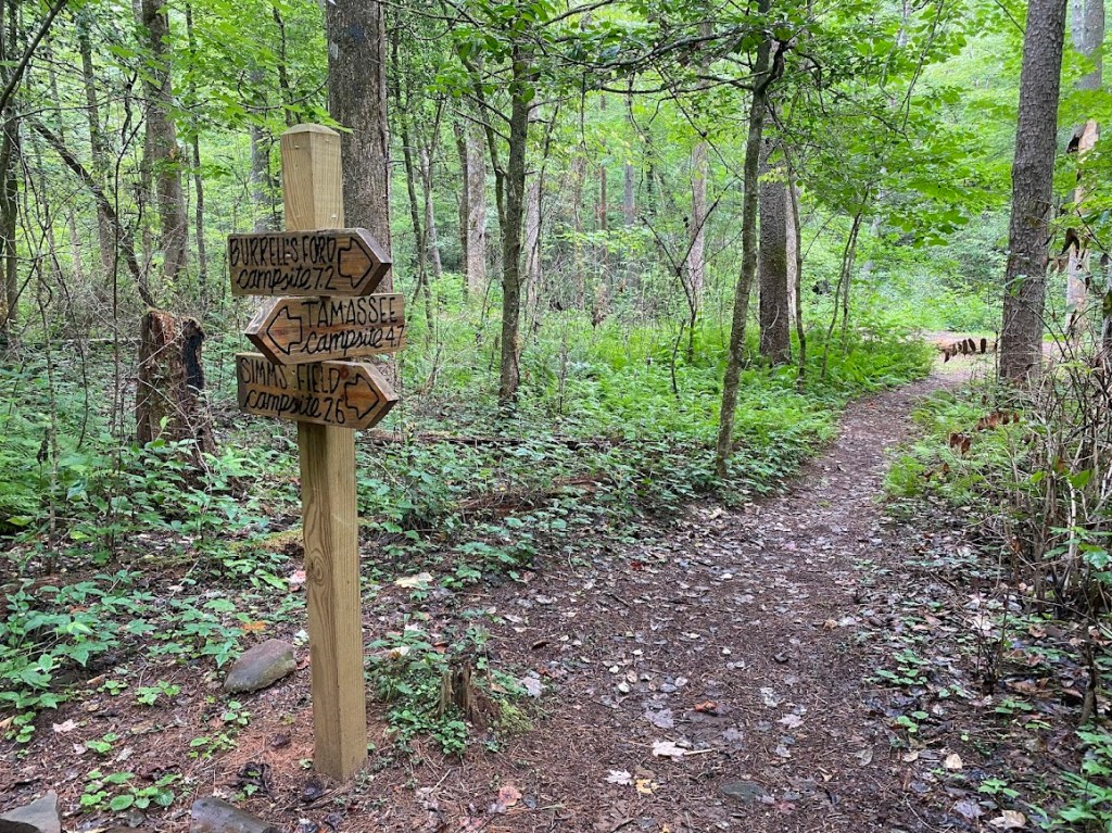
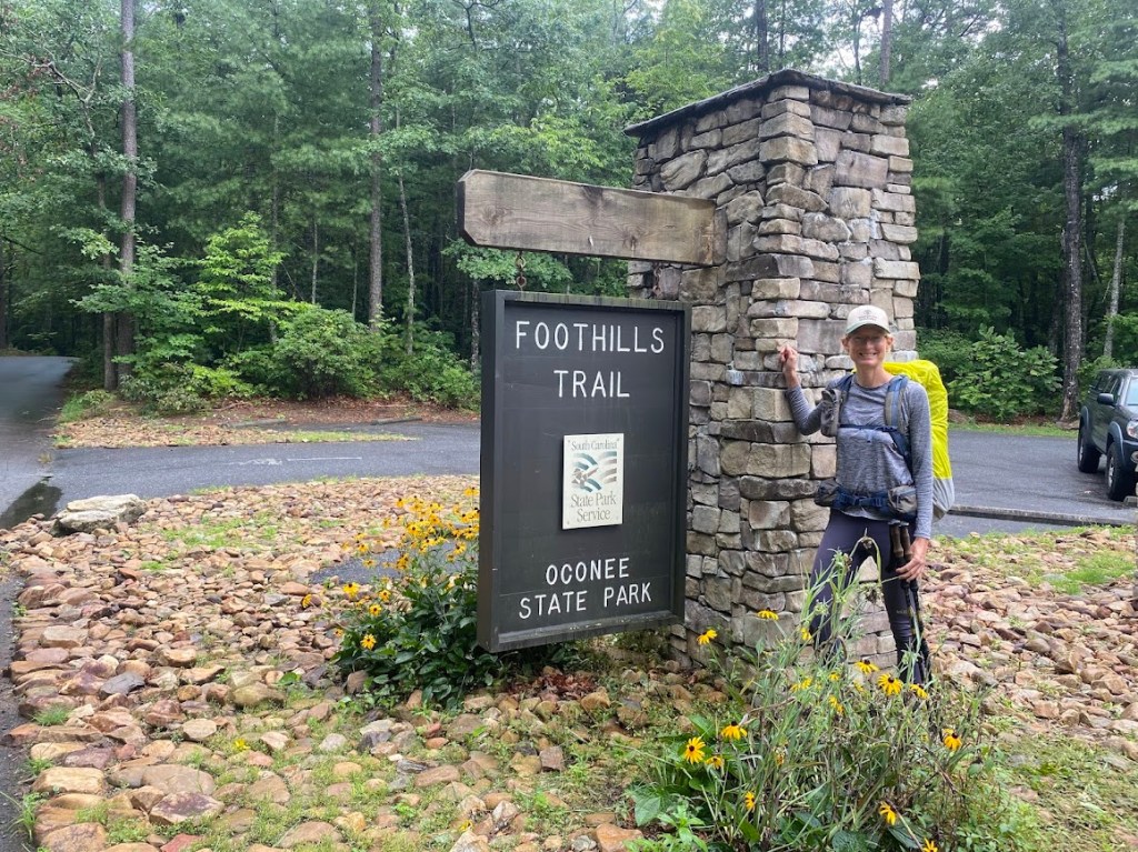
Jim “Taz” Simpson met me at Table Rock State Park. On our drive, he pointed out a few trail crossings and we stopped near the fish hatchery to add ice to his trail magic cooler. Taz dropped me off at Oconee State Park ~6 pm, it was raining lightly. I hiked 3.6 miles to Tamassee Campsite, a peninsula of soft, flat ground surrounded by a creek. I had the campsite all to myself.
July 20
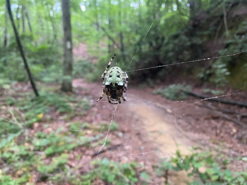
It rained overnight, however my tent was fairly dry in the morning. There were lots of spiders and webs across the trail. I found that wearing my bug net was a deterrent for the web strands and smaller spiders. All the same, I was especially glad not to get caught in the face by a chunky one called a Giant Lichen Orbweaver, a cool name.
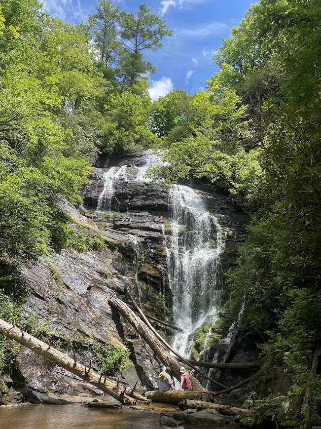
I had a headache all day and finally realized it was from caffeine withdrawal. I took side trips to Pig Pen and King Creek Falls. The latter was particularly impressive and apparently a popular day hike, I saw the first people I’d seen since saying goodbye to Taz. While eating a snack beside the Chattooga River, I watched a crawfish dart in & out of a sheltering underwater rock, trying to catch some tiny fish. I also saw a loon. A trickling waterfall amused me with its name “Hiker’s Peril Falls”. I listened to Spinning Silver by Naomi Novik, it was excellent.
I stopped at East Fork Campsite and it took me a while to find a spot that wasn’t adjacent to a dead tree. Once again, I was the site’s only occupant. It was a 20 mile day, including my side trips to the falls. As soon as I finished dinner, I felt exhausted and went straight to sleep.
July 21
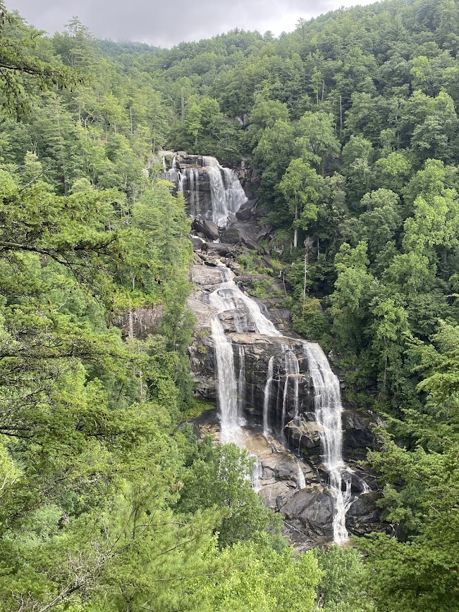
Rain fell from midnight until near sunrise; it left my tent and Ursack wet. On the bright side, I hiked 0.3 miles to a pit privy and was spared digging a cat hole. A light rain fell intermittently, though not much reached me as it was blocked by trees. Late in the morning, shortly before I reached the Whitewater Falls Scenic Area, I saw a small black bear that took off into the woods as I rounded a bend. According to a sign (debated online), Whitewater Falls is the tallest fall east of the Mississippi. It was mesmerizing and spectacular. I chatted with a couple people at the lower viewing platform.
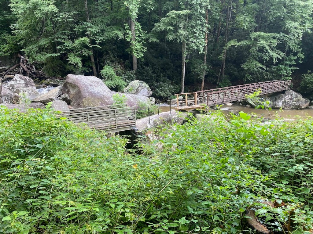
The trail descended to the Whitewater River and crossed a unique bridge, two wooden spans broken by a large rock, out of sight of the falls. A while later, I ate lunch beside the river, sitting on a smooth rock in a patch of almost sun.
The afternoon was full of wet wood bridges (the numerous water crossings always had some sort of bridge), several bushy sections, and more spiders. There was also a long stairway ascent from the Horsepasture River. I decided the terrain was similar to the AT with steep ups and downs, the ups often accomplished via wood block steps. After a 19.3 mile day, I camped at Sore Foot Campsite. I heard thunder and finished my tent setup seconds before rain fell. It poured for hours.
July 22
After slowly breaking camp, my goal was a privy six miles away. The miles crawled, though my only break was to text and Wordle (service was rare on trail). The privy was located in a large campsite near the Toxaway River, where it flowed into Lake Jocassee. I saw my only people of the day in a boat. There were so many established campsites on the trail, many with wood benches and fire pits. If I wasn’t enjoying the solitude, it’d have been eerie that I found each empty. At Rock Creek Campsite, I hung my tent between a sign and horse tie-up so that it could dry while I sat on a bench and ate my lunch. It was sunny for once. I’m akin to a lizard in that I prefer sunshine.
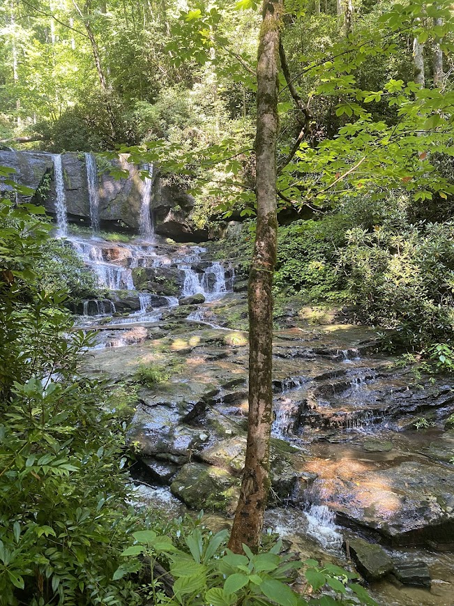
Shortly after lunch, there was a multi-hour downpour where I got soaked, though my pack cover held up. There were benefits to the downpour: I hiked fast, it dispelled the spiders and webs. Also, it wasn’t cold rain. It did prevent me from getting a picture of lovely Laurel Fork Falls. Fortunately, the rain ceased before Virginia Hawkins Falls, which enamored me with a tri-fall drop that became four long silvery veils then split into a multitude of tiny cascades; like a layered cake.
The next downpour coincided with my arrival at the Laurel Valley Access parking area, so I ate dinner under the trailhead sign roof. I’d hiked 19.2 miles and felt no need to push on. There was a dry campsite on the north side of the parking area and I set up my tent during the next lull in the rain.
July 23
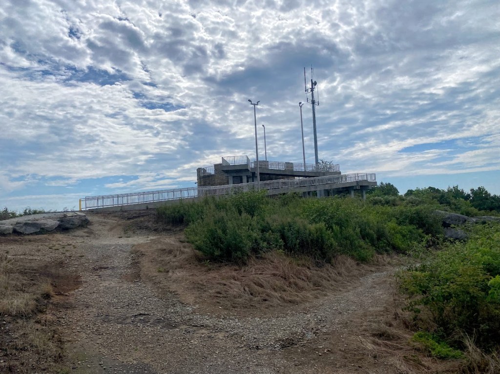
It poured most of the night and on into the morning hours. I woke up ~3:30 am to blow up my Thermarest and found a water bubbled underneath my tent floor with 0.5-1 inch standing in the vestibule. My gear was safely nestled in my pack cover and I was okay on my air mattress raft, but what about when it deflated? (Yes, my air mattress was leaking at a multi-hour pace.) I was too tired to pack and hike so I went back to sleep. When I next woke up the rain had ceased and the water had soaked into the ground. I spent most of the morning climbing to the South Carolina high point: Sassafras Mountain. There was a great 360 degree view from the top. I chatted with a guy who had hiked portions of the trail.
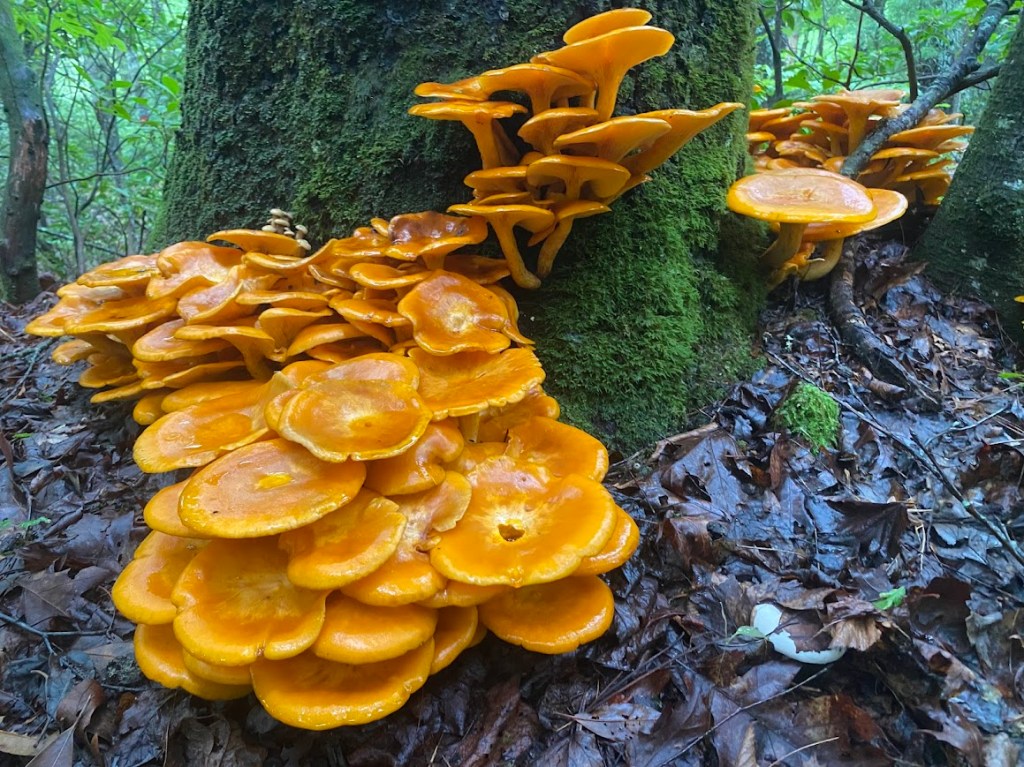
Later on, near Cantrell campsite, I found really cool, bright orange mushrooms called Eastern American Jack-o’-Lanterns. I ate lunch on top of a climb, then crossed a large rock via a cable and gathered water that flowed across the rock. When I reached the Pinnacle trail junction, it was four miles and 2,000 feet down, yuck. There was a great view from Bald Knob only 0.4 after the junction. By ~4 pm, I was at the Table Rock trailhead, having covered 14.5 miles. The trail was over and my car was waiting.
Summary
I enjoyed the long days with 3300 ft. gain, had enough of rain and spiderwebs, and didn’t mind the solitude. It was fun to see a bear and a plethora of waterfalls, creeks, and rivers.

Leave a comment