Day 31
This morning it was my turn to be the slow one; I got distracted by Wordle and texting. Still, we were on trail by 7:10 am. There was no wind and the ensuing silence was peaceful. I saw a jackrabbit bound off and we found a dead fox in the road, its tail so fluffy. We had only a single, 1.3 mile, cross country segment that followed a canyon and ascended one side. Shortly after, Bird and I found a concrete trough with six inches of water. I removed a dead garter snake and we filtered with effort, heavy particulates made it slow going. Post filtering, there was a taste I didn’t care for and green flecks of particulate so I added iodine to the two liters.
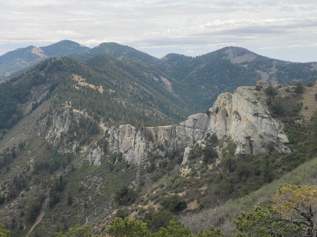
From the trough, it was a mile to the Mill Canyon TH and from there we hiked steeply to the crest of the Magdalena Mountains. The North Baldy trail took us on a ridgeline walk that rose and fell, skirted prominent knobs, and offered fantastic views of the range itself plus its sloping descent to the desert beyond. It was a fun ridge to walk! As we approached the end, I looked back to see impressive white rock cliffs that had been invisible from the top. It was also cool to see the terrain we’d walk across in coming days, including the thin line of the Rio Grande.
Part way into our descent, we stopped for a quick lunch. Then we were on roads full of varying sized rocks that shifted beneath our feet. Bird was very grateful for her new shoes. We passed the old Kelly mine, a headframe the only visible relic. The road became smooth dirt and there was an old church. The last two miles into Madalena were paved. At first all the structures seemed abandoned, then there were homes with barking dogs, a rock shop, and an antique store. We stopped at the Magdalena Motor Inn to pick up our resupply, which we’d seen no reason to carry over the mountain ridge. Nancy was happy to see us and wished us well on our journey.
Bird and I parted ways for dinner. She wanted a sit down, made from scratch meal. Though that did sound nice, the only thing I could eat at the Tumbleweed Diner was fries. Instead, I went to Dollar General and got potato chips plus the Butter Pecan ice cream that I’d been craving. I took my food to the post office, which was warm with power outlets. A few people came in to check their PO boxes and one man, a transplant from Oregon, asked me about my route into and out of town. I went over it with him, which was fun for us both.
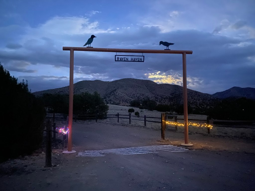
Magdalena was the first town since Alma where I had cell service. Bird and I finished our respective meals, communicated via text, and met at the Steer Stop, a gas station. Then we hiked out of town. It was 3.3 miles to the Cibola National Forest boundary. As darkness fell, I enjoyed a ranch entrance lit by Christmas lights and with the name “Raven Haven”. The moon lit the road so that we didn’t need our headlamps until we climbed the bank to look for a camp site. We found a couple sandy spots near a juniper. Bird intended to cowboy camp until I reminded her there was a chance of rain.
Day 32
I woke to the crisp smell of rain, though my tent and our area were dry. The tent did protect me from a gusty wind that started up during the night. Bird’s tent had collapsed on her twice – stakes pulling out of loose soil – making her not as appreciative. We left camp in a timely fashion, each of us wearing a couple layers up top. I also had gloves on as it was heavily overcast with a chilly wind.
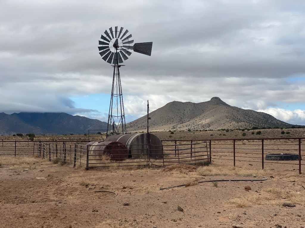
Our route took us across flat cattle land on roads, cross country, and stock paths. We checked out water sources, all tire troughs. At the first one, I gathered a small amount of water and did laundry. The third had a windmill and clear, gushing flow into a gigantic tank that fed a lower tier at cattle height. There were even a few squash plants and a dozen gourds withering on their vine. As I filtered, the cows that ran off at our approach inched their way back to the area. One was a tiny calf that looked only a few days old. When we left, I thanked them for letting us use their water.
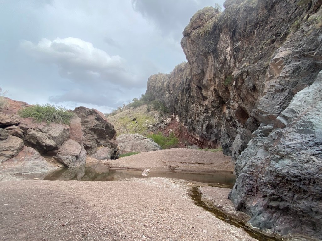
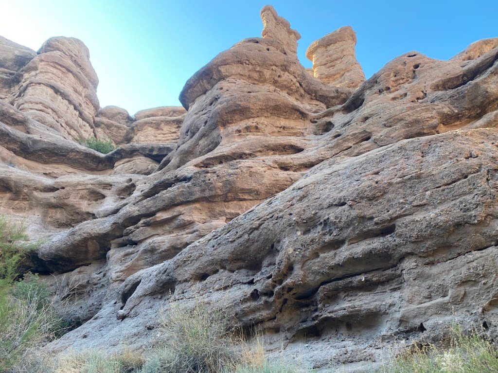
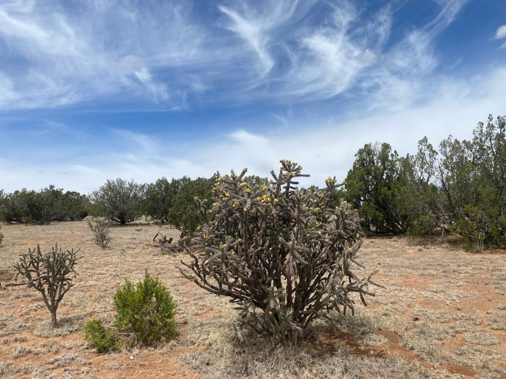
In the afternoon, we hiked through San Lorenzo Canyon, which was awesome! It started with a couple pour-offs, each a 4-5 foot down climb with a small flow of water. Bird descended first and I handed down our packs before I followed. At the bottom, a light sprinkle fell from the sky so we sat under a convenient overhang and filtered water. The canyon had walls reminiscent of those in Canyonlands, layers of rocks with smooth cavities and bulges. A couple spires looked like giant mushrooms, another like a table. We explored a side slot canyon that culminated in a grotto. It’d have been a perfect camp site except we still had a couple hours of daylight. There were also a few people camping and walking in the canyon. The first humans that we’d seen on trail since the Gila.
The canyon transitioned to sandy wash where the walking was soft, yet required more effort. After an hour or so, we saw trucks flashing by in the distance. Soon we heard I-25 traffic noise and left the wash to look for a camp site. We found one partially sheltered from the wind by sturdy bushes. Both of us searched out rocks to reinforce our stakes in the soft soil. This time Bird got a solid set-up on her tent. I followed my dinner with the last two mint Oreos sent by my sister. A wave of tiredness hit and I nestled into my cozy down bag. Suddenly there was a lot of noise and Bird exclaimed that 30 or so ATVs were going past on a nearby road. Luckily it didn’t last long, then there was only wind and the hum of I-25.
Day 33
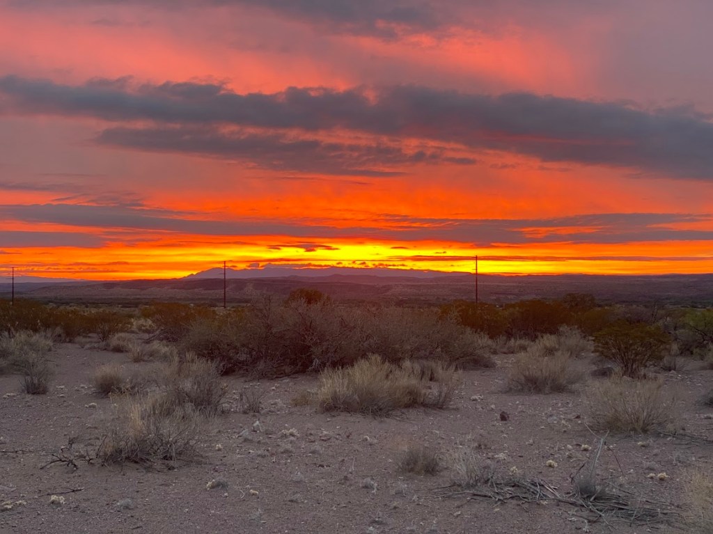
I was really tired so though I woke several times in the night, I fell back asleep quickly. Around 4 am, there was a light patter of rain on my tent and I enjoyed the sound before I drifted off. We arose to a beautiful sunrise and a pleasantly warm morning.
Our route took us beneath I-25, following the wash through an underpass. Then we went over a railroad trestle and turned south on the east-most aqueduct road, which paralleled the Rio Grande and an empty canal. The road was atop a tall berm, perhaps flood control should the Rio Grande rise dramatically. We took a side road that turned towards the Rio Grande, entering a riparian corridor of cottonwoods, willows, and tamarisk. Bird and I hoped to ford the river, otherwise it’d be a 7ish mile detour to reach and cross a downstream bridge. Sadly for the animals and people that depend on the river, the crossing didn’t even reach our knees. It is typically higher in the spring due to upstream snowmelt.
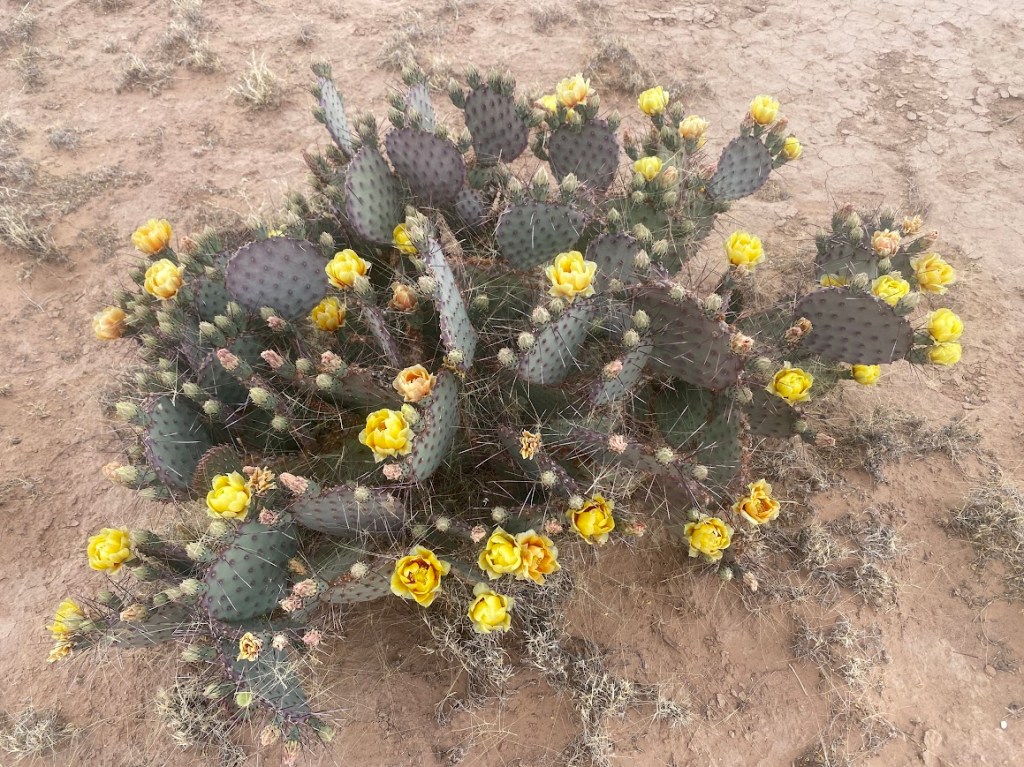
The way forward was a mix of wash, road, and stock paths. I admired the fluffy purple blooms on one bush and used Seek to identify the plant as Apache Plume. The pale yellow blooms of prickly pear cactus kept catching my eye. In our single, non-wash cross country segment, we aimed for the long abandoned Old Stapleton Ranch. Brett noted that he once found a calendar dated 1964 in the house’s kitchen. There were two tire troughs and I found clear water entering one through a pipe with an attached float. From the ranch, we took a road that started out 2-track and became a stock path skirting several foot deep chasms likely made by water. Bird and I chatted a lot throughout the day, discussing board games, films, and books.
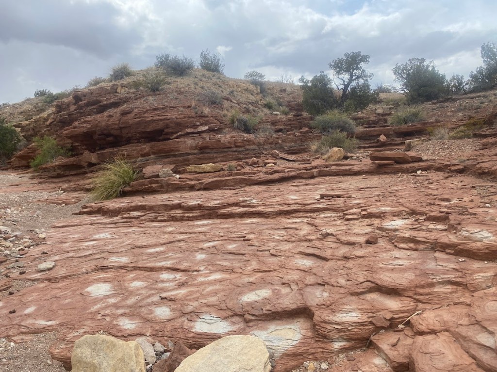
Mid-afternoon, we entered the Sevilleta Land Grant, a large private land parcel deeded to a ranching family. Brett negotiated with the owner, Mr. Lee, for the passage of GET hikers. We’re even allowed to camp on the land as long as we stay 1/4 mile away from water sources. The GET travels 16.5 miles across the land, saving hikers from a longer and more arid segment through BLM land to the south. Mostly we traveled on roads through the parcel, however there was a 2-mile wash section with colorful flat rocks and layered rocks that we climbed in a few spots. Bird and I ended up camping shortly past the last water source, where a working windmill fed water into a giant, rectangular concrete tank. The tank was brimming with clear water and fed a lower cattle trough that contained tiny fish.
Day 34
Upon waking, condensation coated the sloped walls of Bird and I’s tents. Happily, though our sleeping bags were damp, they dried during morning chores. We returned to the road for ~3 miles before leaving it to cross a gap in Grey Montosa Ridge, which had been to our right since leaving camp. We then ascended steeply alongside an eastward fence to reach a mesa. Our route stayed atop the mesa for nearly a mile. Half way along, we slid under a fence and entered BLM land, whereupon we followed a northeast fence. The area between the two fences was a corner of the Sevilleta National Wildlife Refuge.
Eventually we angled away from the Wildlife Refuge, briefly on top of a second mesa before descending to Entraniosa Draw. We crawled under a fence to travel up the drainage for 0.3 miles before turning east to ascend a third mesa. Bird and I continued eastbound until we encountered a wide, flat dirt road which we hiked for 3.5 miles with one stop for a snack break. We departed the road to begin a long cross country segment that wove between private and BLM land. It involved a third fence crawl and we found the first cattle who were not startled by our approach. The day’s final three miles were on a road.
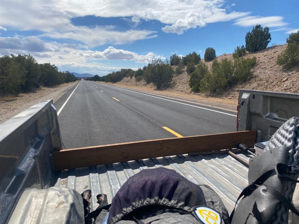
At Highway 60, it was an 18 mile hitch east to Mountainair. We were prepared to wait a while since it was a high speed road, however, a pickup that had gone past earlier returned to ask us what we were up to. It turned out the couple, Ed and Darlene, had picked up a GET hiker pair the previous year. They loaded us and our packs into the back of the pickup and we were off. I enjoyed the sun, whipping air, and scenery as we rode into town. A train went past on our left, headed the opposite direction. At one point, Ed stopped to point out his and Darlene’s home and invited us to stay if we backpacked through the area in the future. They dropped us off at The Rock Motel, where I had a resupply box.
Our motel room was clean with a great shower and plenty of room to spread out gear. I washed my handkerchief and socks in the sink, then laid them and my tent out to dry in the central pavilion area. I quickly ran through other chores such as washing my pot, showering, sorting my resupply, entering water data, etc. Bird planned our route for the coming section before heading to Dollar General for dinner and snacks. She chatted with Mitchell while I texted family and friends. Then it was time to sleep in a real bed, more exciting for Bird than me since I have an air mattress on trail.

Leave a comment