Day 35
We arose eager to check out Alpine Alley, the local cafe, with visions of eggs, hash browns, and (for me) hot coffee. Unfortunately the cafe was closed when we arrived and calling the phone number provided no further information. We went to the local hardware store to look for isobutane fuel, also a bust, and were told that the cafe is closed the first Monday of every month for food restocking; our bad luck. I went to the gas station to get hot coffee, which really was my priority. It nicely complemented my oatmeal.
At 10 am, we wandered over to B Street Market, the local grocery store, so that Bird could get a resupply with fresh vegetables. I got a plum to go with my lunch and spinach to put in a couple of my dinners. While I looked into how much water we needed to carry out of town, Bird hurriedly bagged and organized her resupply. Then Melina (she and her husband own the hotel) took us back to the trail in her car. She chatted about Ed, he used to be sheriff, and how they can’t find anyone to clean rooms at their motel. Sooner than expected, we were back at the trail.
For nine miles, the route followed washes and I entirely enjoyed it! The washes were a mix of firm gravel, soft sand, flat rocks, and jumbled rocks, the latter which required hops or steps to navigate. I had fun quickly picking the best path. And after a drought of reptile sightings in the last section, a gorgeous Eastern Collared Lizard posed on a rock for me. It had hues of yellow and green plus two black rings around its neck.

After four miles, we turned onto a red hued wash with shallow, algae lined pools. On a rocky ledge, I observed a Bighorn Sheep skull. We also paralleled and eventually passed beneath the Burlington Northern & Santa Fe railroad trestle. It was a busy railroad as four trains, two in each direction, went by before we turned northeast, away from the tracks. I was in the lead on a wide section of the wash when I heard a rattle. This drew my attention to the right and there was a Western Diamondback rattlesnake. It was alerted, the front third of its body arced off the ground and its rattle pointed skyward. Bird and I admired it before swinging wide to give it space as we passed. It was the first rattlesnake that I’d seen in New Mexico!

We ate a late afternoon snack on a large, smooth rock centered in the wash and near an overhang with mud-daubed bird nests. Then we left the wash to hike cross-country through golden grasses with occasional tree chollas and junipers, the Manzano Mountain range looming ahead. After another 1.5 mile wash segment, we found a 2-track road and followed it to the last flat ground before the route narrowed to pass between hills. We made camp in a spot sheltered by junipers, which turned out to be fortuitous when evening ushered in a gusty wind. Bird shared her thoughts on Harrow the Ninth, her current audiobook and one that I read last year.
Day 36
I woke to a light rain and dark, overcast sky. The rain let up while I dug a cat hole and ate breakfast, then resumed after I took down my tent. Since we were on the Sand Canyon detour (really the main route now due to a homeowner association that closed the original route) we decided to cross-country toward Padilla Trick Tank. Solitary White-stem Evening Primrose blooms were sprinkled amongst the grass. As we neared the tank, we angled north to pass between two hills and over a ridge, ending up on Priest Canyon Road. We followed it for 2.5 miles, passing a few Red Barberry bushes, which were filled with yellow blooms and smelled great. Three deer trotted onto the road, eyed us, and returned whence they came. Later a solo deer bounced across the road.
At the Pine Shadow Trailhead, we scooped water from the spring then retreated to the covered vestibule areas of the 2-room vault toilet to filter water and snack. While I had my umbrella and was hence fairly dry, Bird’s rain jacket had soaked thru and wet her sun shirt and sports bra. For our break, she took off her wet base layer and put on her puffy to stay warm. When we set out, we had a nearly 3,000 ft. climb ahead of us to gain the crest of the Manzano Mountains. It warmed us up!
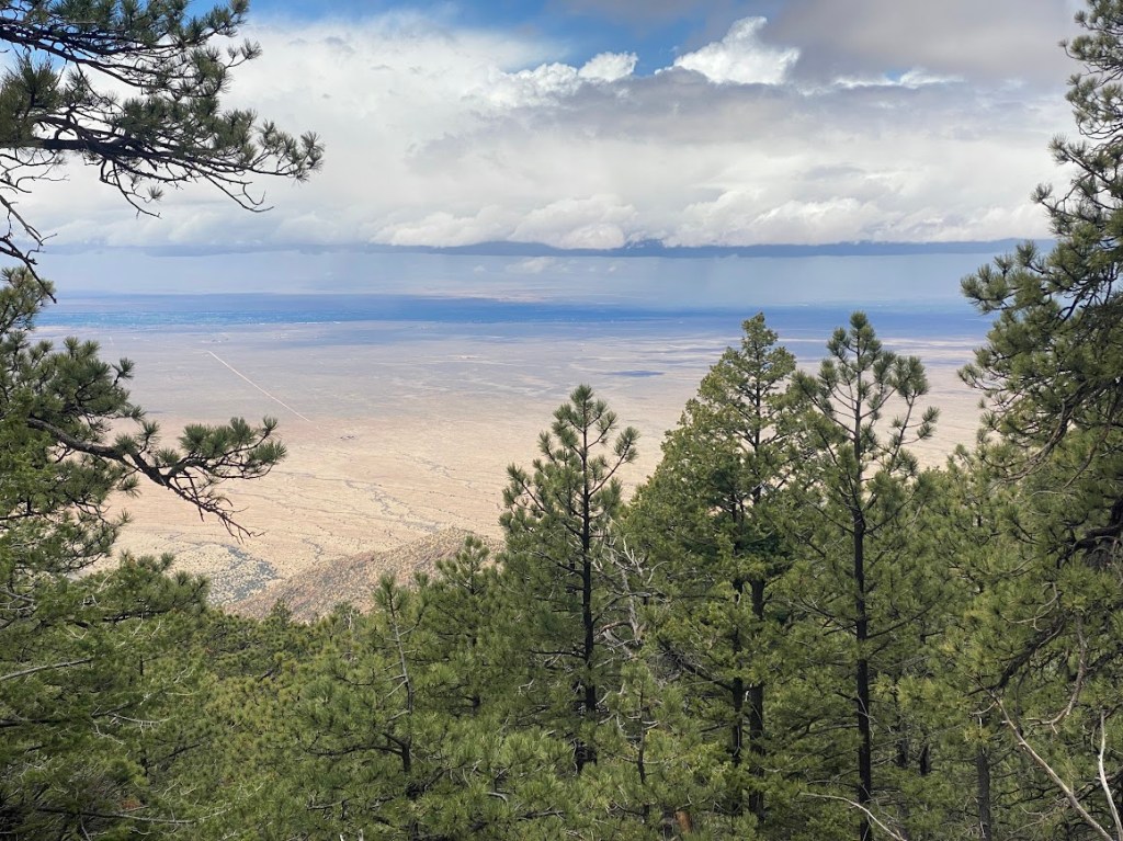
For a long time, there was no view to be seen as a thick fog obscured the surrounding hills. Then it lifted in part to provide an enticing glimpse of blue sky. Further along we enjoyed full sunshine for a bit, while our pants were soaked by a patch of rain-soaked brush. I got a glimpse of desert plain and a line of storm clouds. Then the fog drifted in once again. As we topped out at ~9,900 ft., we turned onto the Manzano Crest Trail. Manzano Peak was a short side trail away, however at that point there was no view to be seen from the summit so we skipped it. When the sun peaked out again, we snuck in a quick lunch break that ended with renewed rain then brief, tiny hail.
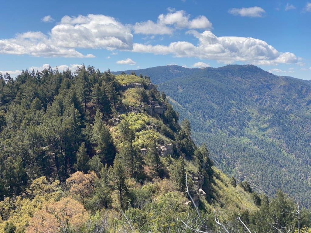
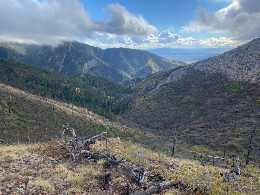
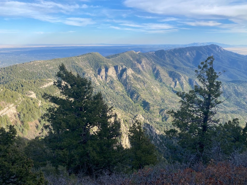
Other than a one mile road walk at the very end, we were on the crest trail the rest of the day. The trail was easy to follow and mostly clear of debris. When we got them, the views were commanding, a sky island range in the midst of desert plains. We got hailed on once more, followed by a light rain, yet the day actually ended with several miles of full sun. The trail passed just below Gallo and Osha peaks, descending eventually to 9,200 ft. The clouds, distant rain, and sunbeams made for vibrant photos. A couple times, I saw deer descend from the ridge at our approach.
We stayed in Capilla Peak campground, the only occupants. It was an odd campground, lots of cement pads and picnic tables; few spots to pitch a tent. We did find one semi-protected spot big enough for both our tents and near a pit toilet. It felt great to put on warm, down layers and get cozy. Bird used the last of her fuel to treat herself to a warm dinner. I was very grateful for my umbrella as otherwise my rain jacket would have wet out, resulting in a cold and miserable Strider.
Day 37
Overnight it rained lightly and in the morning my tent had frozen droplets and frosty edges. Still, as I ate breakfast, the sun shone on our site and rapidly warmed us. That’s the thing about life outdoors, the cold moments give me greater appreciation for the warm ones.
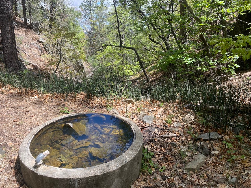
It was a mostly downhill mile from camp to our water source. Rather than push through a brush-clogged drainage, we hiked to Brett’s waypoint then angled downslope through forest. There were two, circular troughs, each about 1/3 full. I removed a dead bird from the blue one so we opted to filter from the other. The water was a vibrant green and it slowed our filters dramatically after only one liter. The taste was okay.
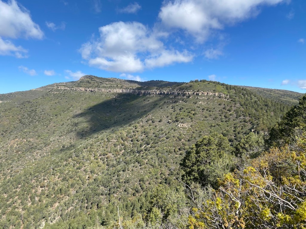
We followed the Manzano Crest trail for another 8.5 miles. It took us past long, flat Bosque Peak, distinguished by a thick granite striation. I admired the white blossoms on a Cliff Fendlerbush. Later on there were two pointed peaks, Mosca and Guadalupe, each with multiple granite striations. As we hiked through the range’s northern portion, the trail became less distinct, however, large cairns and occasional pink flagging kept us on the correct path. We stopped around 2 pm for lunch, the late time our new standard as we tend to stop for a hearty mid-morning snack. It was a beautiful spot that contained a circular cement trough brimming with clear water and green reed grass. We remembered to spread our wet gear in sunny spots.
Another 1.5 miles of well-maintained trail took us to the Albuquerque Trailhead, from which we hiked 6.6 miles on a mix of dirt and paved roads to Tajique, a tiny village with a convenience store. We entered the store and got a couple V8 beverages, then filled water bottles at the spigot out front. The route continued along a quiet county road, past occasional structures and the entrance to “El Rancho Costa Plenty”. As a beautiful sunset lit the sky behind us, we crossed a sagging fence onto land that may not have been public. We camped on soft soil near sheltering junipers and hidden from the road. It was timely, while we ate dinner, the sky let loose an on & off, light rain that pattered against our tent walls.
Day 38
Frosty tents again! The cold was unexpected due to our low elevation of 6,500 ft. Oh I was warm enough, simply reluctant to leave my cozy, down bedding. Then nature called and momentum carried me onward. From camp, we hiked cross country until we found a spot to cross a sturdy, 5-wire, barbed fence; I felt a pang of sympathy for the deer and elk. Thought we were beginning an 18 mile highway walk, I was delighted by the sun’s warmth and the movement of my body.
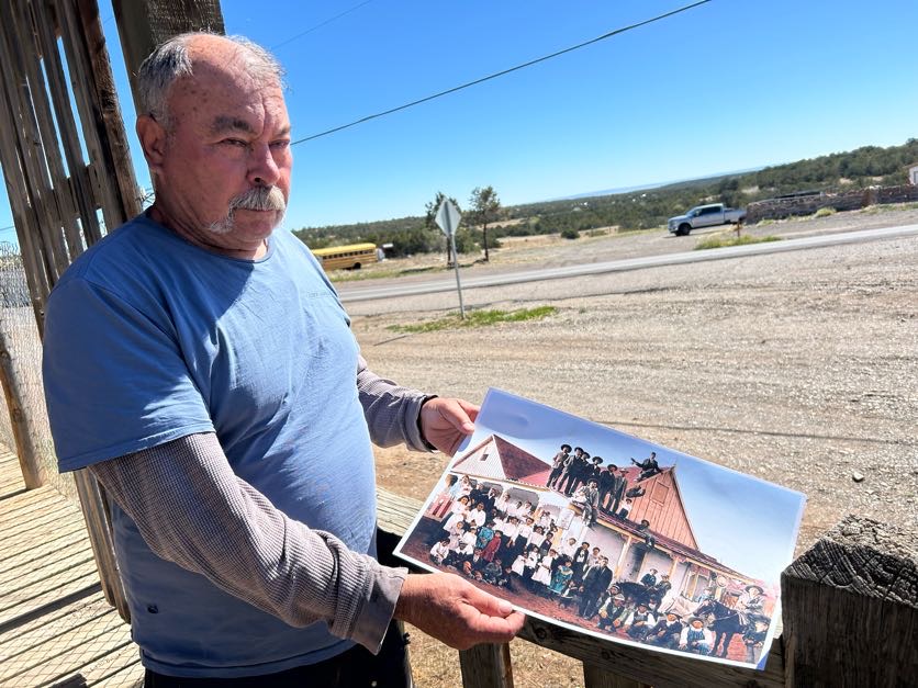
The road had its attractions and traffic wasn’t heavy. I passed Mosca Peak Ranch and was pleased to see that its entrance gate framed the peak that I admired yesterday. The roadside barbed wire fence reminded me of one of my favorite country songs, Went for a Ride, so I listened to my country playlist. After seven miles, the highway took us through Chilili, a community built on an old Spanish land grant. As I admired a lovely mural and description of the local church’s namesake, a man seated on his porch called out to me. His name was Don and he was curious about our journey. Once we explained, he fetched a picture taken on that very porch in 1912, when New Mexico became a state. It showed a multitude of men, women, and children; well dressed and with serious expressions. He pointed out the sheriff and gave names to many of them. Bird and I enjoyed the glimpse into the community’s history. Don also explained that the name Chilili means weak stream.
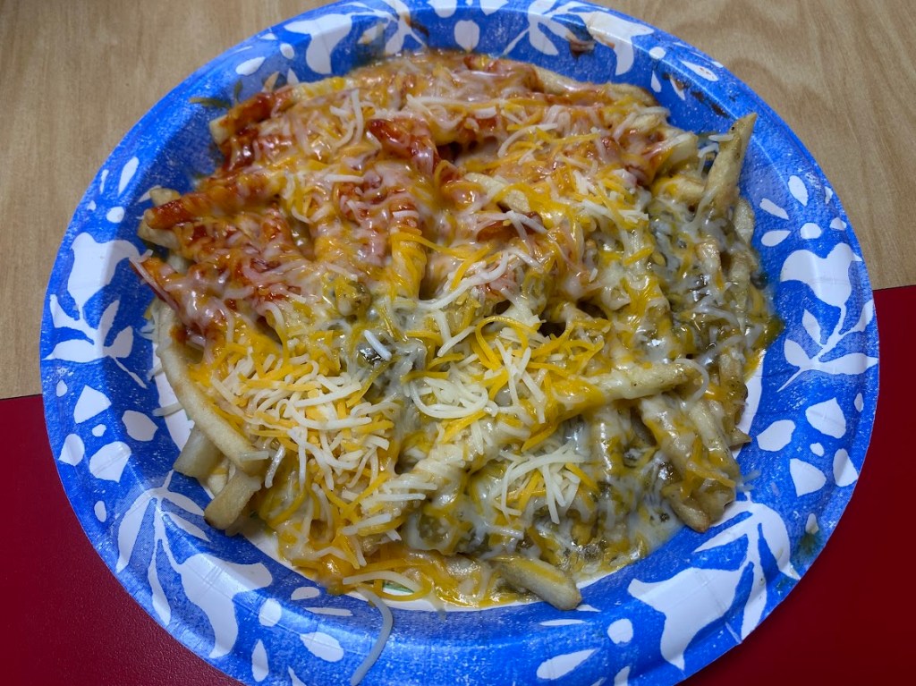
After 13 miles, we took a break at Ten Points General Store. I got hot coffee and ice cream while Bird got a breakfast burrito. We chatted with the friendly store owner who had explored the Manzano Mountains via horseback. He mentioned a restaurant further along the road with good food and prices. I liked the idea of snacking our way up the highway. We walked 3.4 miles to the High Mountain Grill. The owners were super friendly! They let us spread wet tents in their yard to dry and inquired about our journey. Then I got green & red (Christmas!) chili cheese fries and Bird got a Reuben with fries.
We were at the grill for nearly two hours as Bird was selecting & securing housing for her fall turn at Colombia. When we left, we had 1.8 miles of highway and 7.5 miles of mountain bike friendly singletrack to reach our camp spot. Bird said we could shorten the distance by continuing along the highway. I was eager to be on trail so we split up when we reached the trail junction. It was wonderful to be back in the woods with bird song instead of traffic noise. The singletrack was curvy and rocky, but well-maintained, I encountered only one downed tree. The Three Bottles trail was a little annoying due to easy, medium, and difficult branching options. Over time I realized the most direct path was to stay left because difficult for a mountain bike was not challenging on foot. As sunset approached, I saw Bird’s tent and set up my own across from it.
Day 39
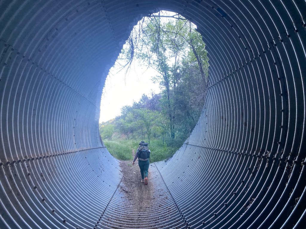
Between dry tents, a pleasant temperature, and light breakfast, it was a snappy morning out of camp. The first two trail miles contoured along hillsides with a sweeping view of pine covered hills and the approaching Sandia Mountains. We traversed a culvert under the highway and took mountain bike trails for another two miles. A mile of highway walking delivered us to the front door of Roots Farm Cafe. Before we went inside, I petted a friendly white cat named Cigarette. My second breakfast was a latte plus a cheddar, gouda, and roasted red pepper grilled sandwich on GF bread; it was very cheesy. Bird and I chatted as we ate our delicious food.
As we left the cafe, I was curious about the mining operation on the opposite hillside. I looked up GCC and saw that the Tijeras location consisted of a cement plant and limestone quarry. We walked through a couple blocks of town before hiking under I-40 and up a quiet paved road. The road terminated at a trailhead where we got on the Sandia Crest trail. Via a multitude of switchbacks, we gradually climbed 2,000 ft. to the ridgeline. Then we climbed another 1,000 ft. to pass near South Sandia Peak. It was a sunny, warm day with hardly a cloud in the sky. The views were far-reaching, however they included too much city for my taste, especially as Albuquerque came into view.
I was excited by two lizard sightings! The first had a greenish tint and long slender body. It didn’t let me get close enough for a picture, though I witnessed an impressive jump from rock to rock. The second was a Greater Short-horned lizard that let me approach and cocked its head delightfully as if eyeing me. Horned lizards have become one of my favorite species! Though Bird and I ate our lunches separately, we took a mid-afternoon snack break together. Afterwards, the Gamble Oak that had obnoxiously crowded the trail gave way to lovely pine forest. I admired ridges of limestone that cut across several hill faces.
We camped at 10,000 ft., slightly southeast of the Southern Sandias overlook. The view was fantastic; I could see most of the ridgeline we had traversed that afternoon. It was our last night on trail together and Bird wanted to cowboy camp so I joined her in sleeping under the stars. We chatted while we organized our spots and I ate dinner. Bird drank rehydration salts to fight off a headache from under-hydrating and showed me several pictures from her time in Zambia. I soaked my breakfast then gave her half of my remaining water. She went to bed shortly after her dinner, while I wrote and gazed at the night sky.
Day 40
I really enjoyed cowboy camping: branches waving overhead, turning in the night to see the lights of Albuquerque contrasting with the moon, watching the sun light the horizon in pink shades. We were on the move prior to 7 am, eager to reach the Sandia Peak Tramway. Though we could ride it all the way to the trail’s terminus and save hiking 4,000 ft. downhill, what would be the fun in that! No, we were eager for water and found a working spigot on the back of the building. I had hoped to reach Sandia Peak’s summit, one of the highest points on the GET, however the entire summit area was closed for a fuel reduction project. We backtracked a short distance to take the La Luz trail.
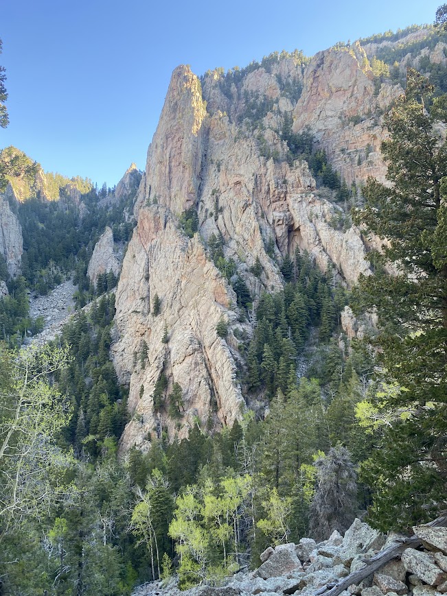
Initially the trail was tucked just below the ridgeline, short rock walls to the right and the mountain dropping off to the left, with loose areas reinforced by rock & mortar retaining walls. Eventually we intersected the trail that we’d have taken from the summit and at that point La Luz began a descent toward the city. It was gradual due to plentiful switchbacks, which passed through patches of loose rock. Every so often I paused to admire rock slab faces – reminiscent of Boulder’s Flatirons – that rose above evergreen dotted slopes. As we lost elevation, the trail became smoother and cacti replaced the trees. We encountered lots of people hiking towards the summit, though foot traffic fell off drastically when we turned onto the Tramway trail for our final 2.4 miles.
At the trailhead, there was no monument or any other indication of our achievement. We took a picture together then pictures with a rock and cacti backdrop. Afterwards, we hiked to the tram base station. Bird called an Uber; our garrulous driver had recently retired and was exploring Albuquerque via Uber. He also enjoyed a job he could set aside at any time to visit family or travel overseas. Our destination was an Enterprise office where I had reserved a car. Bird and I loaded our packs into a silver Toyota Camry. I drove while she navigated and soon we were on I-25 headed for Santa Fe.
In Santa Fe, I drove to a storage facility where Bird left her belongings. Her car didn’t start and it turned out her jumper cables were locked in a trunk that wouldn’t open without power. Luckily, she found a guy with a truck who jumped her vehicle. I helped her load the car with storage shed items, then we hugged goodbye. She was a fun hiking buddy, perhaps we’ll do a future trail together!
My next stop was Back Road Pizza, where I got a delicious pizza on a GF crust topped with marinara sauce, cheese, and lots of vegetables. Then I headed south, through Albuquerque, to Los Lunas, where I stopped at Walmart to gather half of my trail resupply. I drove until I got tired, which ended up being in Lordsburg. This time I slept in the Camry, however I recalled last November, when I stayed at the Econolodge with trail friends after finishing the CDT.

Leave a comment