Day 41
I woke and immediately went to a gas station for coffee. As I got back on the interstate, I called my parents and we had a long chat. Another hour or so, with audiobook Tart to entertain me, and I was in Tucson. I went to Natural Grocers for the second half of my resupply. Then came repackaging my new food into Ziploc bags left over from the last two sections. After lunch, I got gas and drove to the airport to return my rental car.
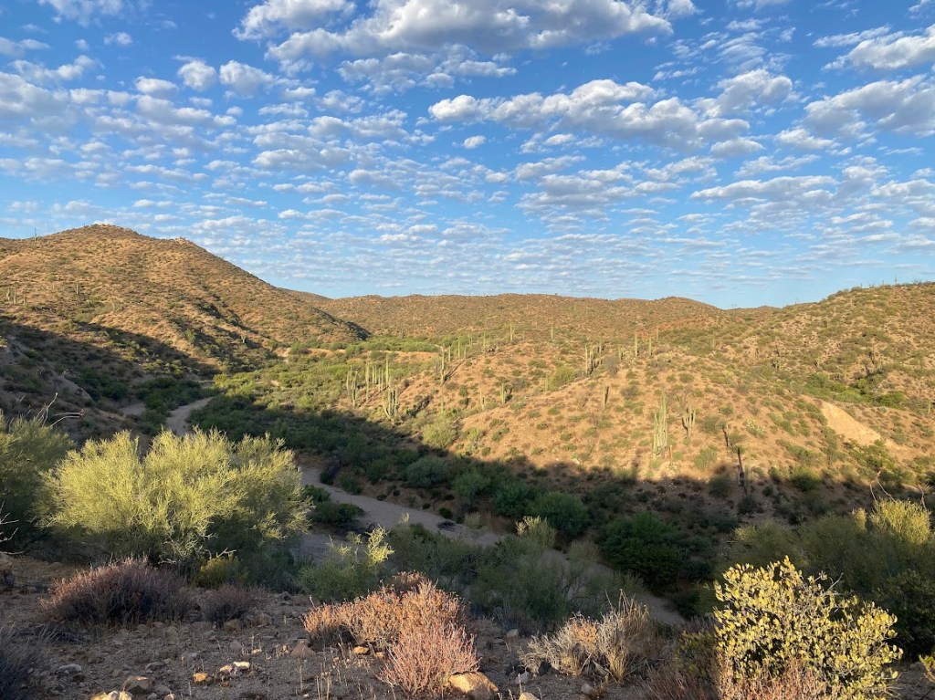
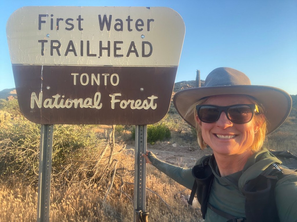
From the airport, I took a free bus north to Tucson’s downtown area to cut over $20 from the quoted Lyft ride price. Scott was my driver, a Tucson native with a family and three Persian cats. At 3:40 pm, he dropped me at the Central Arizona College Aravaipa Campus and I set out westbound, which felt slightly odd after hiking 650 miles eastbound. It felt good to be back on trail, in the final stretch!

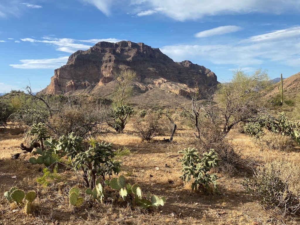
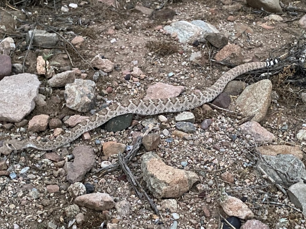
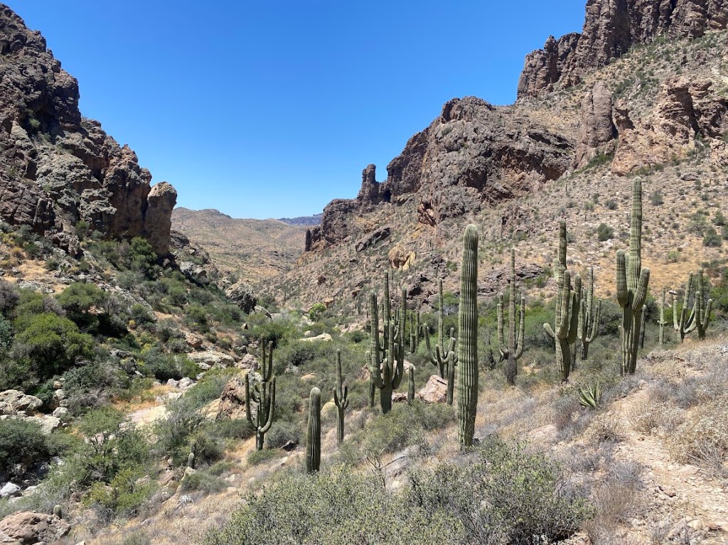
My heart sang to see saguaros once again! At first, the route was an easy road walk followed by a horse trail through open desert land. Then, in typical GET fashion, it bushwhacked one mile through the San Pedro riparian area. I floundered for about 1/3 mile, crossing fallen cottonwoods and pushing through thorny trees before happening on a decently trodden path. My relief didn’t last long as it took me the wrong direction. I corrected my course by following a rocky drainage west and happened upon a Western Diamondback rattlesnake, which buzzed and arced in a menacing manner. Though I enjoyed seeing it, I did watch my steps in the ensuing brush. Then I found an easy to navigate drainage headed south and went under a fence to emerge at an Arizona Game & Fish sign.
Late afternoon and early evening found me on a 2-track road through two scenic washes. A roadrunner zig-zagged across the road. Then I saw three, adorably tiny lizards the length of my first finger joint. One let me get close enough to identify it as a Common Side-blotched lizard. I felt excessively thirsty – likely my body adjusting to the heat – so I was happy to discover a flowing stream in the wash. I filtered one liter and didn’t at all mind the slight cow taste. A long, chill gopher snake slithered from the road to disappear amongst vegetation. As darkness fell, the GET merged with the Arizona Trail. I ate dinner beside a metal trail marker then climbed 0.2 miles to a flat spot where I pitched my tent. I saw a jackrabbit and took it as a good omen.
Day 42
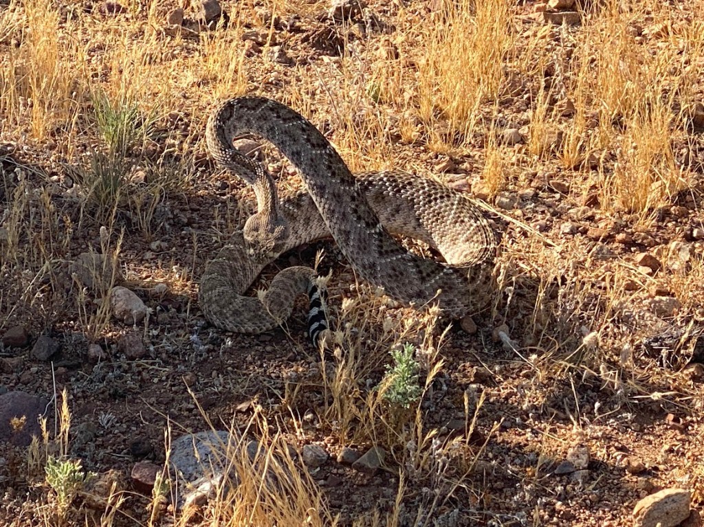
Almost immediately after setting out, I saw a saguaro whose every limb had white flower blooms; how beautiful! The trail made a three mile half circle around Antelope Peak. Again I heard the buzzing rattle of a Western Diamondback rattlesnake. This time I got a good, clear picture of its arching form. A short while later I saw a quail family, the chicks were adorable! All around, the cholla trees were heavy with fruit that pulled the attached appendages toward the ground.
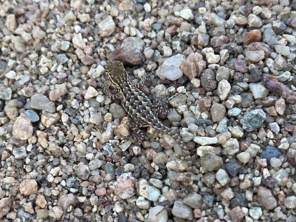
I took a break at a rainwater collector, filtering water and eating a hearty snack in its solid shade. The collector is such an innovative way of collecting moisture in the desert, I wondered why there are only two along the trail? Later I was walking a dirt road where I startled two, pale green lizards with black & white tipped tails that curved upward. When they ran, the lizards stood upright on their four limbs. I got only one blurry picture, however I am excited to look them up in a book when I get to town (they turned out to be Zebra-tailed lizards).
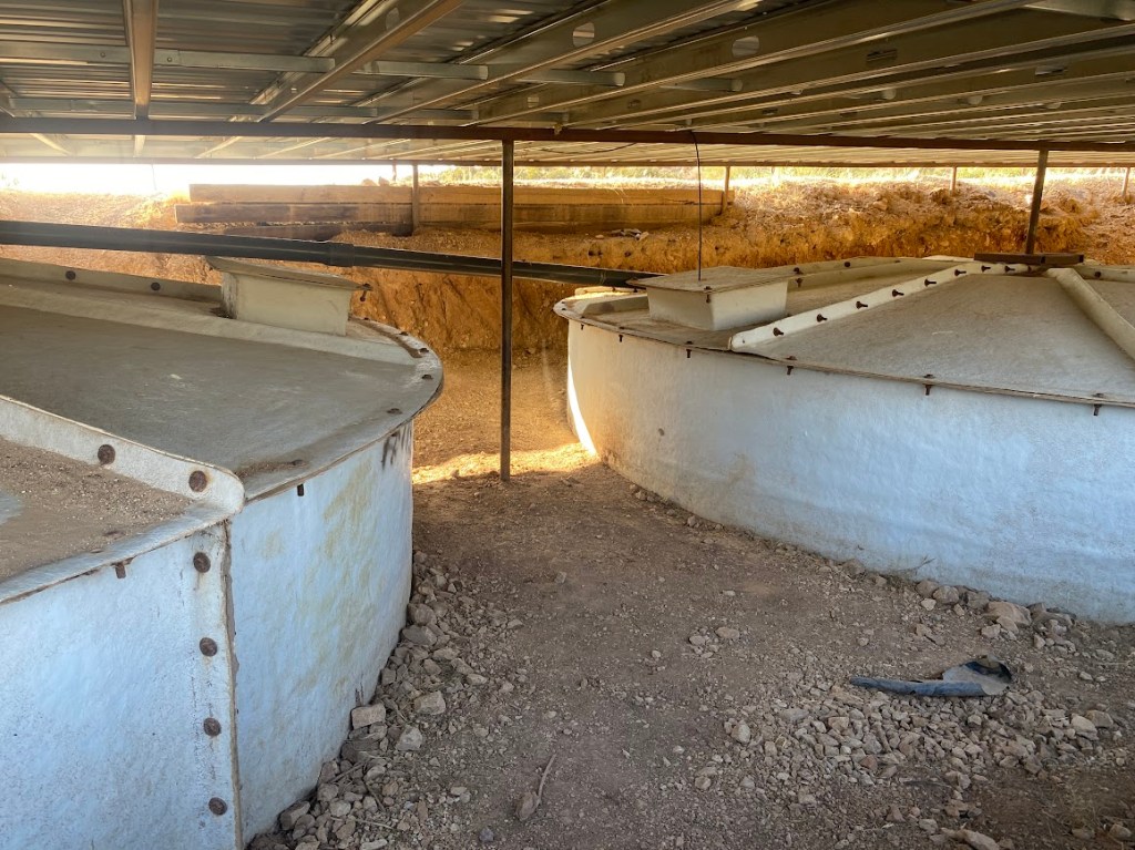
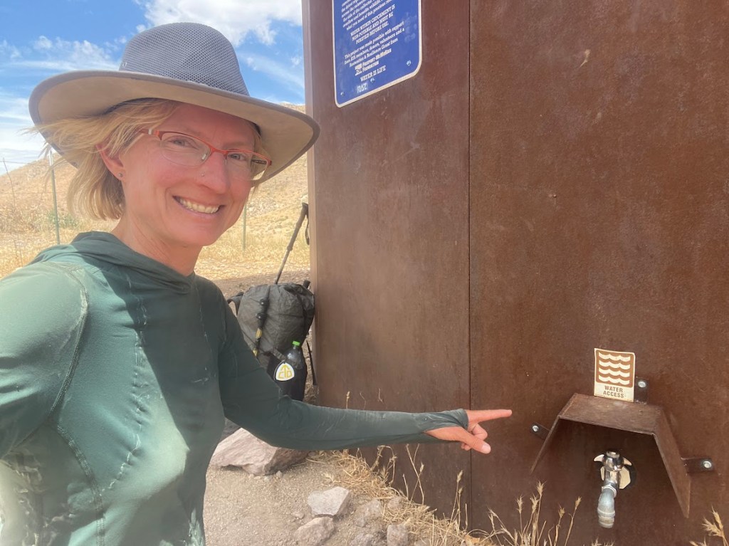
At 1:30 pm, I took an extended lunch break in the dense shade of a juniper. I was happy with how my body had handled the heat, though I was helped by a good breeze and my sun umbrella. Plus, it had cooled off during the night and the day took a while to warm up. I was also doing my best to drink a lot of water. In fact, I stopped several miles later to refill my bottles at a wildlife guzzler. Per the FarOut instructions, I avoided the hornet infested open water pool (for wildlife) and slid under the metal catchment roof. There were two tanks and one had an access hatch secured by only two bolts. I unscrewed one and rotated the lid to dip my filter into the clear, good water. There was so much water in the tank! I filtered a couple liters, soaked my dinner, and did laundry with filter water.
In the day’s remaining hours, I saw lots of bunnies and jackrabbits. I made a brief stop, right before I turned on my headlamp, to get one more liter of water from a spring fed barrel resting in a dry metal tank. It had a spigot and I recalled its location from my Arizona Trail thru hike. Then I went 0.7 miles and pitched my tent near a trail / road junction. The spot had a great view and a giant saguaro nearby. I’d done a 25 mile day and felt good.
Day 43
As I ate breakfast in my tent, the day already felt warmer than it had yesterday morning. I hurried to pack up and get going. I’d gone a short distance when I paused to admire a vista full of saguaros and small, fluffy clouds. Then the trail climbed to a ridge where I had cell service. I found a rock, sat, did Wordle and shared my results, and sent a few texts. In the distance, near Kearny, was a giant open pit mine. A couple miles later, I hiked past the Florence-Kelvin Trailhead and entered territory that I had traversed twice before, once north and once south.
Ten miles into my day, I reached the water spigot made accessible by Kelvin’s Highway Department. Next to it was a shady picnic table. It was 11:30 and I decided to take an early lunch break… the heat was getting to me! It was definitely hotter than the previous day, likely the predicted 103 degree temperature. I ended up hanging out for 2.5 hours. An older man stopped to get water from the spigot and we chatted for a while. I wasn’t really hungry, though I ate lunch and let it settle. Mostly I hydrated, recovered, and caught up on my trail journal.
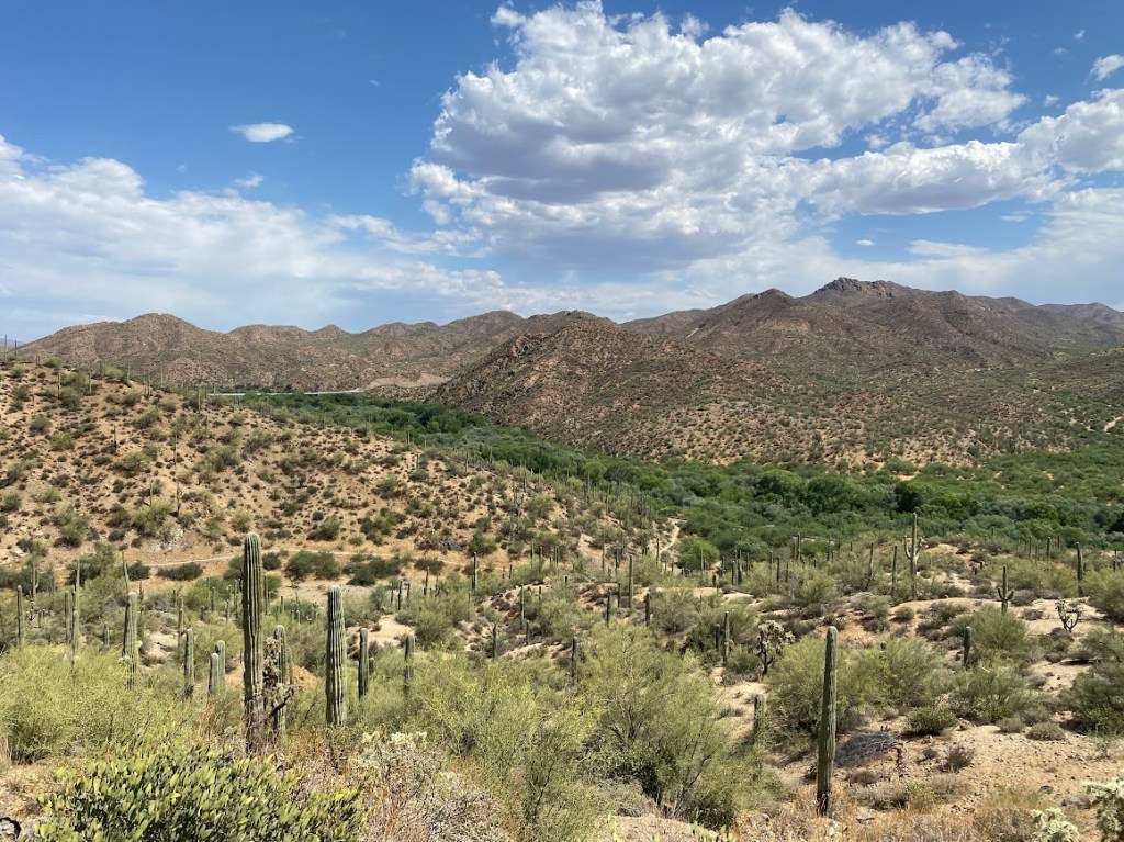
From Kelvin, the trail paralleled the Gila River, continually climbing and descending to go above or under the steep bluffs that formed the river’s north side. The river itself was not visible, hidden under a forest of green tree tops. A quiet train track followed the river’s other bank. I saw fast moving lizards, but no sign of the Sonoran Desert tortoises that I observed on the AZT. Despite my sun umbrella, the heat was oppressive. I stopped to mix electrolytes and sort of regretted it as the raspberry flavor tasted unappealing in tea temperature water. When I got a side ache, my first of the trail, I took another short break.
Though my pace felt tortoise like at times, I continued to hike and, for an hour-ish, welcome clouds covered the sun. I encountered a skinny cow with a bell around its neck. The poor thing seemed out of sorts, catching one horn on a cacti before trundling off. Then came a colorful sunset and shortly after I saw a chill Diamondback, stretched full length with its head right at the trail’s edge. Only its tongue flicked out as I stepped off trail to give it space. A colorful sunset lit up the sky before I took a wash down to the Gila River. I took off my pack, ducked through a fence, and gathered three liters of water via headlamp.
The brown Gila water filtered surprisingly well and had no noticeable taste. I made my way back up the wash before I hiked ~1/2 mile, to a high spot in the trail, and ate dinner. A Garmin weather check at my location revealed it would still be 90 degrees at 9 pm, wow! I night-hiked until I got tired, covering several more miles and achieving a 25.7 mile day. At one point, I saw a tarantula; its body appeared white in my headlamp’s red light, though its legs were still a fuzzy black. I briefly considered cowboy camping until I recalled the spiders I saw in the dark.
Day 44
Overnight it cooled off enough that I tucked myself into my sleeping bag (I’d fallen asleep directly on my air mattress). The cooler air was welcome as I flew through my morning routine. In 0.6 miles, I reached the Arizona Trail low point and turned north, away from the Gila River. I was about to head up Arroyo Canyon, a particularly scenic portion of the AZT. The GET had diverged a couple miles earlier to explore the White Canyon Wilderness. Though I loved the idea of exploring a new area, I had continued on the AZT for two reasons: water and a defined trail. Addressing the latter… I knew the shorter GET route would involve a degree of bushwhacking and route finding. That sounded onerous if it was a hot day and I again had trouble with the heat.
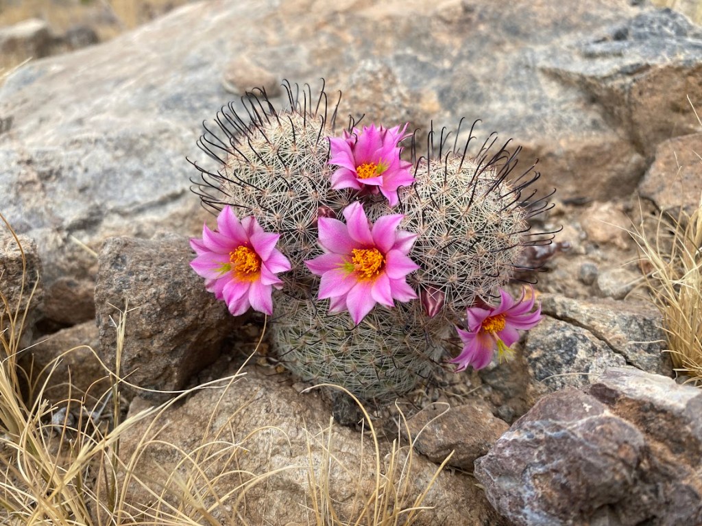
The temperature was pleasant on account of an overcast sky and intermittent breeze. The climb was gradual, with long switchbacks, and wound amongst hills topped by varying rock formations. Saguaros sprinkled the landscape and I saw the cutest tiny cacti spotted with pink flowers. I crossed a high saddle then followed the trail along the side of a valley. It switchbacked close to a tall and imposing rock spire. As the trail climbed once more, I looked for and spotted the rainwater collector perched aside a tall hill. That is where I took a long break, eating lunch and drinking the fresh-tasting water. The collector’s wide, in-sloping collar created a superb shady spot.
Back on trail, the sun shone full force and I mixed Chocolate Salt electrolytes (thanks sis!) into my water. It was perfect as the flavor is meant to be warm. I listened to an audiobook and admired rocky bluffs, accented by yellow layers, high on the hillsides. Mid-afternoon, the imposing bulk of Picketpost Mountain came into view. The trail swung in a 120 degree arc around the mountain’s left side and passed through Picketpost trailhead. I left trash in the vault toilet’s receptacle before I continued to the water cache. There was plenty of water, courtesy of trail angel MJ. I ate dinner and filled five liters, unsure of water sources in the coming section. At twilight, I took the concrete tunnels under split Highway 60. Then I hiked by headlamp for three miles and camped atop a ridge.
Day 45
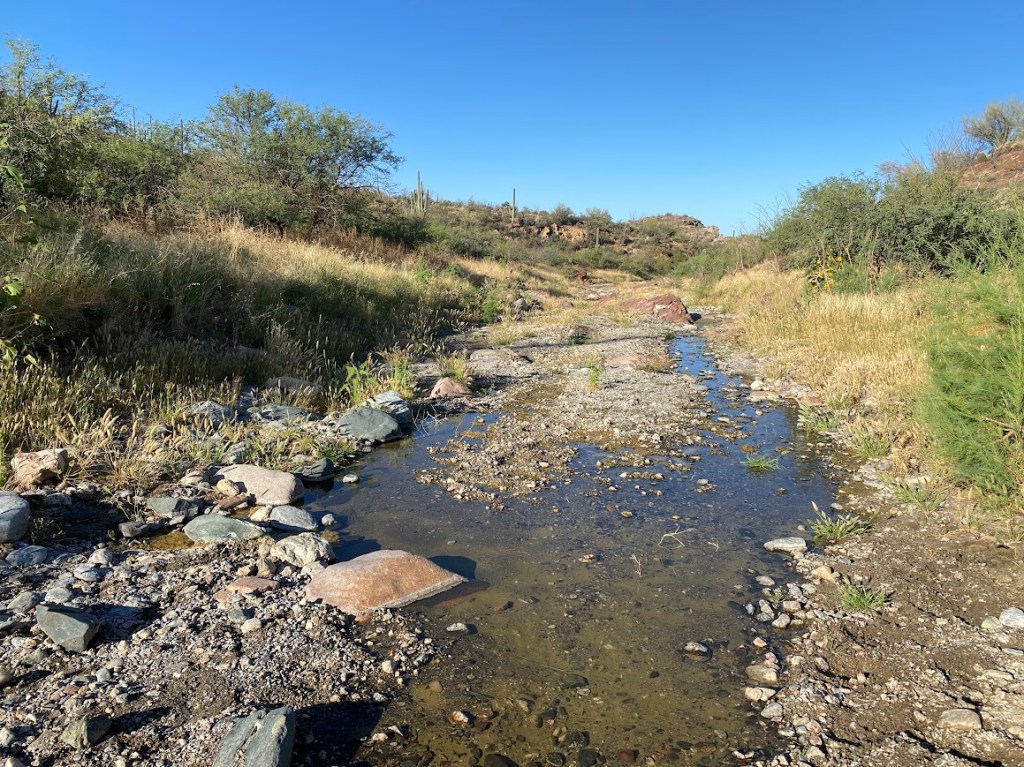
A couple miles from camp, I delightedly discovered clear water flowing in Whitford Canyon wash. I took a brief break to drink, refill water, and do laundry. Tall sunflowers grew at the wash’s edge. Continuing on, the trail wove back & forth across the wash before entering low desert hills. I recognized a spot where I camped with my sister and our friend Amanda on my first foray into AZT Passage 18.
A short distance into Reavis Canyon, a Diamondback rattled at me as it wound itself backward into brush. I never tire of seeing the temperamental species, yet I’d barely thought how I wished to see another rattlesnake variety when a black head emerged from a bush. The snake, an Arizona Black?, saw me and quickly turned, flashing a bit of black body as it slid away. Elated by two snake sightings, I moved along with vigor. At the canyon’s northern terminus, the trail turned left and climbed 1600 ft. I completed 60% of the climb before my energy waned and I stopped to snack. Then I put on an invigorating music playlist and soon found myself atop the ridge below Montana Mountain.
At the Roger’s Trough trailhead, I ate lunch and saw two white-tailed deer high on a hillside. There was a vehicle with Oklahoma plates and a half mile-ish along the trail, I encountered its owner. Vance had a backpack full of rocks and an enthusiasm for the Lost Dutchman mine, which is rumored to be in the Superstition Mountains. He knew the area well and showed me pictures of a quartz vein, rock formations in which he saw evidence of Apache and colonial Spanish interest, and a purported Sasquatch. The last was far off, blurry, and possibly a rock. His friend saw the Sasquatch near the Roger’s Canyon cliff dwellings and Vance said he’d heard it moving rocks in the night. I don’t believe in Sasquatch, however I wasn’t ready to meet one solo and was happy that I intended to camp miles beyond the dwellings. I enjoyed Vance’s passion for the area.
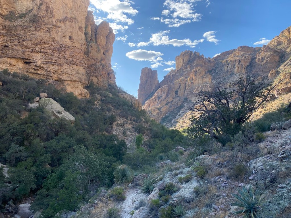
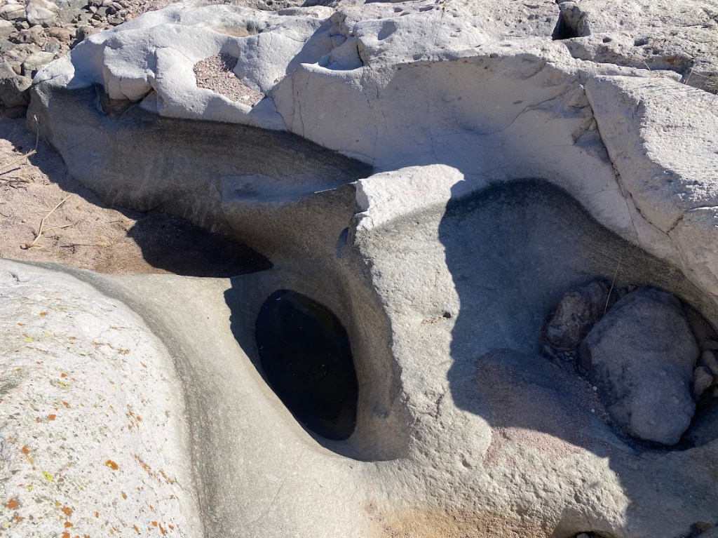
It took me 1.6 miles of hiking to reach an intersection where I said goodbye to the AZT (for now) and turned left into Roger’s Canyon. There was a small water cache at the sign and I took 1/2 liter of water. The canyon actually had a trail, which was fantastic as I’d expected to either walk the wash or forge my own path. The canyon had amazing rock walls as I got close to Angel Basin, a grassy meadow. The trail became a boulder-strewn affair and I happened upon a tinaja, a bedrock pocket with a small amount of water. It was clear and covered in water bugs so I filtered a liter. I had hoped to explore the cliff dwellings, but I looked in the wrong spot, forgetting that Brett’s waypoint descriptions were written for an eastbound hike. I did not backtrack.
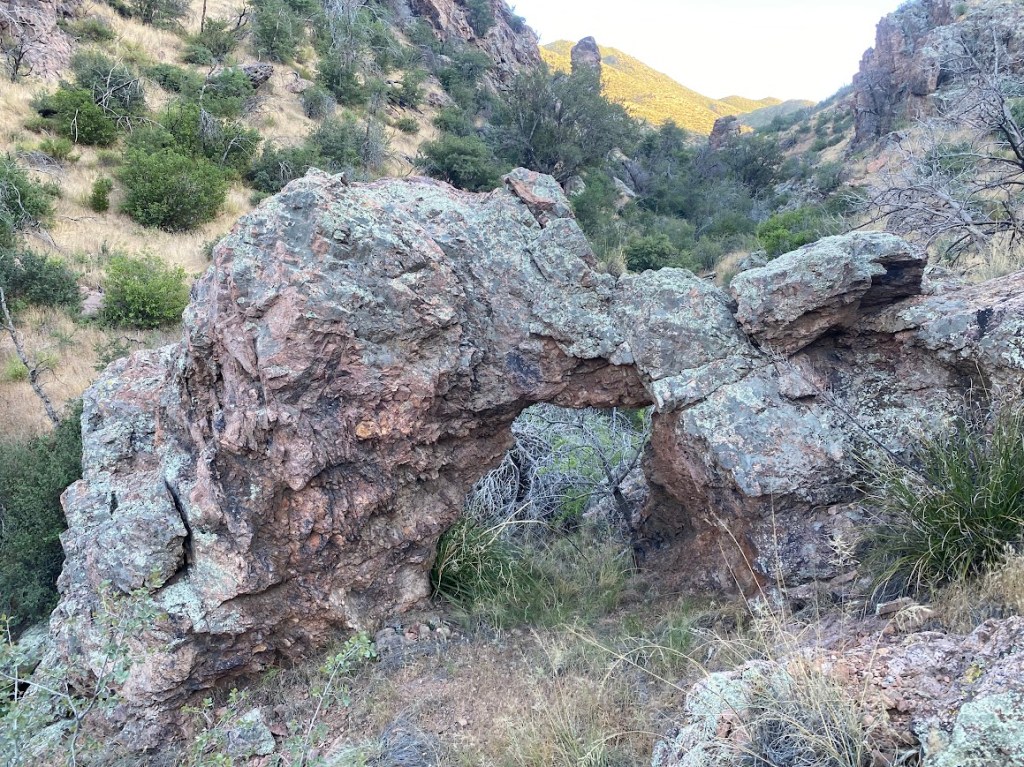
Less than a mile beyond Angel Basin, I discovered a neat stone arch adjacent to the trail. The route then ascended to Tortilla pass, which had stellar views both forward and back. I eyed a nice campsite before continuing on another mile. It was dark when I reached the top of an unnamed pass. Since the ground was too hard to get in a single tent stake, I decided to cowboy camp. It was likely my last night on trail anyway so I wanted to soak up my environment. Plus, it was my first time solo cowboy camping! While I ate dinner, I put on my puffy to ward off the chill of a strong breeze. Brilliant stars speckled the night sky.
Day 46
I started the day with two liters of water and a definite desire to find more. Tortilla Creek seemed like my best bet; Shane noted it had a lot of water mid-March. The trail paralleled the creek so I took an animal path over to the wash. It ended at a bedrock area where I found a tinaja with water that smelled vaguely like a pit toilet. I filtered two liters and, when it tasted gross, added iodine to both. Then it tasted like iodine, woohoo for always carrying a backup way to cleanse water! I continued listening to an audiobook titled The City & The City.
My favorite portion of the day’s trail was Upper LaBarge Box Canyon. It had steep walls composed of pitted and bulgy rock spires plus a plentitude of saguaros. The trail rose and fell steeply. At one point, my feet slid on loose pebbles and I landed gently on my butt. I took the moment to drink. In one spot, I spotted several large water pools in a bedrock area of the canyon’s wash. I seriously contemplated finding a way down to them, however it was too steep and a long descent. Once the terrain leveled out, I took a lunch break and drank chocolate electrolytes. I dreamed of town beverages, not food.
About an hour after lunch, I walked a short distance along LaBarge Creek wash, took a narrow tunnel cut into thick vegetation, and found LaBarge Spring. It was beautiful! Clear water flowed into a concrete wash. I filtered several liters and treated myself to afternoon coffee. Fully hydrated, I set out with renewed energy. Very near to the spring, I startled a mostly brown snake with yellow stripes, likely a Garter Snake. The route turned to follow the Dutchman trail, which was the best trail I’d seen since the AZT. When the route turned south once again, I didn’t follow it. Instead I climbed up and descended down Bull Pass, which saved me 1.5 miles. Once back on the Dutchman trail and 4.6 miles from the First Water trailhead, I used my Garmin to message friends and request a pickup.
The approaching evening brought many sightings of quail, both adults and babies, as well as bunnies. The trail got even wider and softer as it drew closer to civilization. Friends Mel and Adam offered to fetch me at 7:30 pm. I reached the trailhead early so I snacked and watched the light fade from the sky. Three bats swooped in pursuit of unseen insects. My friends arrived and we chatted all the way back to their home in Mesa.

Leave a comment