Day 7
Though Martina and I closed all the blinds in the Bygdestua community room, I woke early due to light. I did a yoga session, using a mat that I found in the closet. Afterwards, I used the InstaPot to make hot water for coffee. Martina heard me moving around and also got up, stating she was not a morning person. I am a morning person (and a night owl), however I reined it in. I did notice that Martina’s resupply was entirely carbs and inquired why she didn’t have cheese, which I knew she enjoyed. She was worried about it keeping on trail. I ensured her that a cheese block keeps well for multiple days even in hot weather.
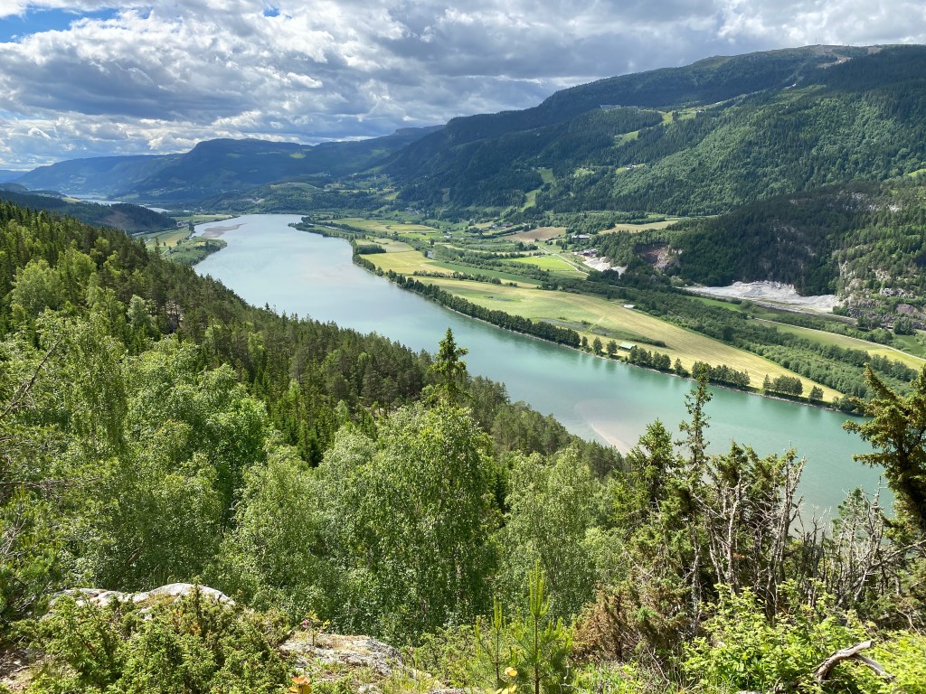
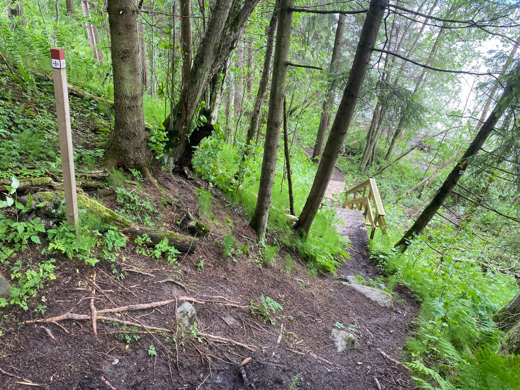
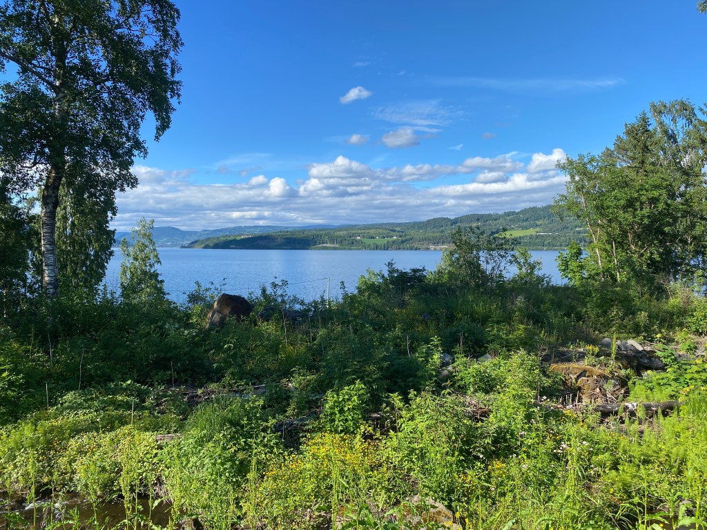
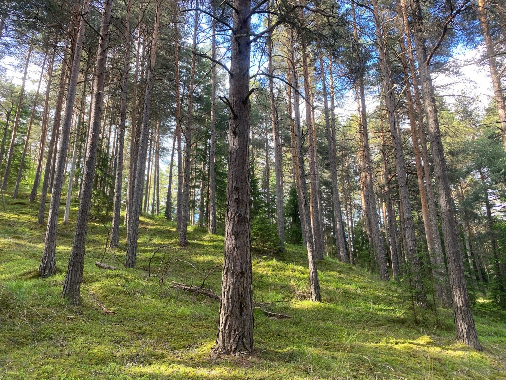
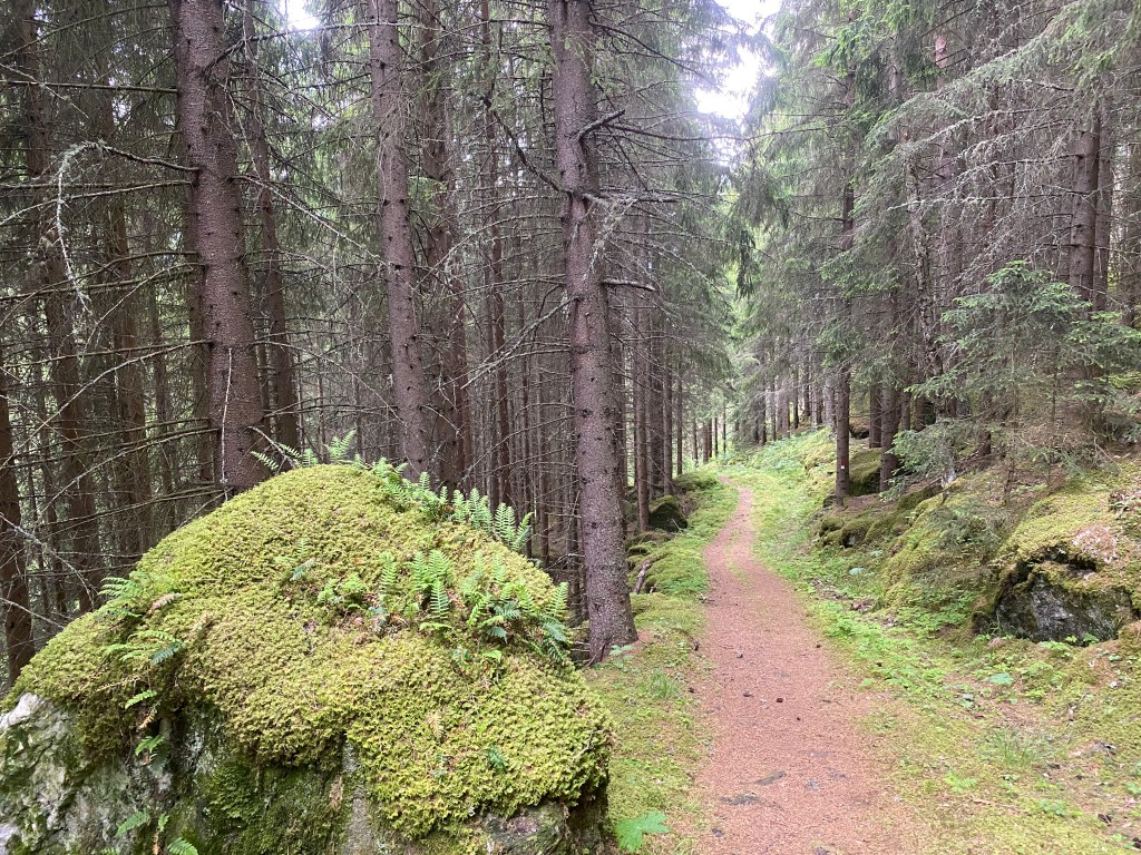
Following goodbyes, I set out, first exploring the park-like church yard and circling Hoff Church. Within 45 minutes, I caught sight of Mjøsa, Norway’s largest lake. Another hour and I was hiking along its shore. The path got muddy at times, full of puddles from the recent rain. There were three stairways that took me up and over fences plus several narrow creeks to jump across. Wind blew through the trees and stirred up the lake water, which lapped at the shore.
On the edge of a field, I caught sight of a pilgrim with a dog. She stopped for a break so I waved and joined her; I’d been contemplating a snack. I met Pauline and Ruben the Airedale Terrier, from the Netherlands. Ruben was friendly with soft fur, he reminded me of Ollie (a dog that I pet-sit) so I immediately liked him. Pauline had two other dogs back home, which her husband was watching along with their pigs, chickens, and AirBnB. She camped the prior night at a developed campground and had booked a hostel in Gjøvik for the night. Pauline said the stairways were tricky with Ruben as she took off his pack and had to help him up & over them; I hadn’t considered that aspect of hiking with a dog.
The path followed the lakeshore for another four kilometers, offering beautiful views of the lake. Then it turned away and joined up with a bike path along the road into Gjøvik, a town of ~31,000 people and the largest since Oslo. It took me a couple hours to hike through the town and its outskirts, though that included a snack break at a handy picnic table. Since I had to pee, I went to the closest gas station, a Circle K (I wonder how that chain ended up in Norway?). While there, I also filled my water bottles. Making my way back to the trail, I encountered Pauline & Ruben. We chatted as we walked together, until they turned off to the youth hostel.
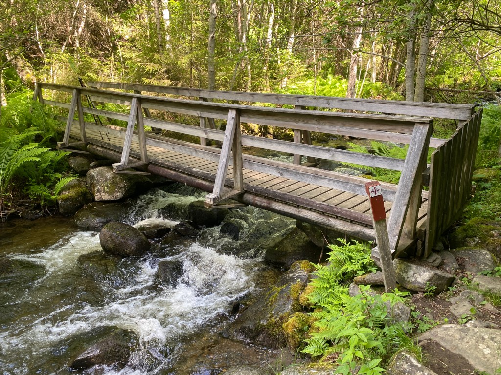
On the outskirts of town, the trail climbed a ridge then descended to cross a bridge over a deep ravine. Next came a steep climb to a forested ridge. Though I had daylight and energy to walk further, the next descent would put me into a long corridor between steep hillsides and the highway, in other words, not good camping. Near the Ramberget Lookout TH, I found a tent site in the midst of trees. I ate dinner and watched the last 30 minutes of Bugonia. As I finished the film, I was struck by intense stomach cramps. I rushed away from my tent, across a pathway, and began to dig. I could tell I wouldn’t make it in time and went on the ground, finishing the hole after and relocating poo with a stick; not fun! I did have time to dig a second hole before another bout of diarrhea. I wasn’t sure what triggered the episode.
Day 8
In the morning my stomach still hurt, though I was able to eat a small breakfast. Despite this, I found the day’s hiking beautiful and sunk into the flow of the world around me with no urgency to reach any particular destination. For a long time, the path stayed in forest or on the edge of fields. I was suspicious of the water in one of my bottles and had dumped it. When I found a clear stream I filtered a liter of water, then added iodine to cleanse the bottle. It was overcast and chilly enough that I left my beanie and fleece on until I began a steep climb.
The path followed a lightly traveled dirt road into the tiny town of Biri. On the way out, I stopped at a cemetery for water. Then came a long stretch where the trail paralleled Mjøsa’s shoreline, though a couple hundred feet above it and Highway E6. I found a bench with a view and ate lunch. While I ate, a cute, male pilgrim approached and stopped briefly to chat. He was Norwegian, with a large pack, and was camping every other day. It was nice to see another pilgrim my age.
When I reached the turnoff to Furuodden Camping, a developed campground, I stopped to examine my map. I didn’t see anywhere good to wild camp prior to Lillehammer and since my stomach still ached, a bathroom sounded nice. It was only 250 NOK (~$26) for hikers. The camping area had clean toilets, showers (20 NOK extra), dishwashing stations, and a clothesline. It was also on the lake’s edge with a great view. There were two tents in the hiker / cyclist area, one with two adjacent bicycles. I set up in the same patch of grass as the other tent and its occupant turned out to be the Norwegian pilgrim, Thomas.
On the grass outside my tent, I did a quick yoga session, read my guidebook, and ate dinner. Then I wandered to a dock at the water’s edge. Thomas was there reading and we ended up chatting for a while. He’d done a Camino pilgrimage and was curious about the Pacific Crest Trail. I talked about the trail and encouraged him to try it . After the Camino, he’d spent time in the Netherlands, though he actually left Norway at age 20 and lived abroad in Hungary and Mexico. We talked about our families, learning to drive, female vs. male hikers, and the books we were reading. It was fun! Thomas planned to meet his mom in Lillehammer the next day, to switch out gear and watch the World Cup game. When shadows covered the dock, we walked back to our tents.
Day 9
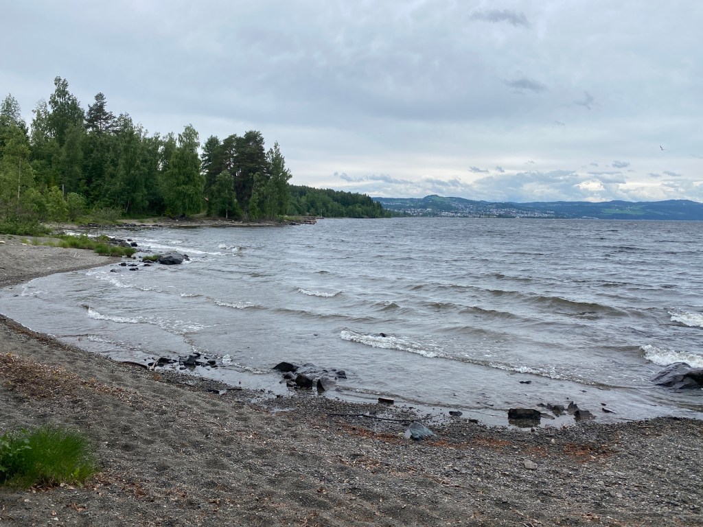
Shortly after rising I had a normal poo, yay! None of the other tenters had stirred by the time I left. The morning took me through country backyards interspersed with forest. I saw a couple electric lawnmowers; there were so many in Norway! I smiled each time I saw one, it was like seeing a cute domesticated creature. The path kept me above the E6 until mid-morning, then dropped down to a parallel road. Happily, all the highway traffic took one bridge into Lillehammer, while the pilgrim path took what appeared to be a pedestrian only bridge. I gazed at lake Mjøsa, which purportedly contained 20 species of fish.
Almost immediately, the path took me to Lillehammer church, which had a stamp! Next it traveled Gamlevegen (the old road), a name I translated on my own. Despite having a population size similar to that of Gjøvik, Lillehammer felt smaller and the buildings appeared older. It is known for hosting the 1994 Winter Olympics. As I was low on food, I went to a grocery store in the northern part of town. I was happy to find an oat crispbread that I hadn’t seen since Oslo, plus other items that have become my staples. In order to throw away my trash afterwards, I ate lunch at the edge of the parking lot.
Leaving Lillehammer, I hiked along bike path or the road’s edge for ~10 kilometers. Other than views of the river Lågen, which flows into lake Mjøsa, there wasn’t a lot to see; I caught up on podcast episodes. At Ensby, I crossed the E6 and took a forest road past a scattered cluster of homes. One place had a superb rendition of the pilgrim path symbol carved into the arch of a wooden gate. Around 3:30 pm, I arrived at an elaborate gapahuk. It had a pumped well, solar powered electrical outlets, a toilet, and separate eating & sleeping shelters. There was even a Leave No Trace sign! It was early, regardless it seemed a shame not to stay. Still I had to convince myself it was okay, that I’d done 26 km and this was not a thru-hike where you constantly push.
The Cinderella incineration toilet was intriguing as I hadn’t been introduced to the concept. Unfortunately, it was finicky. When I arrived, someone else had not flushed their packet and when I tried to do so it resulted in a yellow light and continuous beep. I unplugged the toilet and read the manual’s troubleshooting section. I got it working; the metal chute opened and dropped the old packet into an incinerator, then it was ready for my use. I inserted a fresh paper cup and successfully dropped it after I was done. Noticing that my pants were dirty, I washed them with the well water and laid them to dry in the sun.
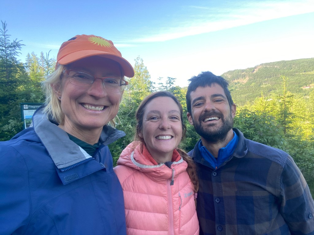
I was about to do yoga when two cyclists arrived and we chatted for the next hour. Jordi and Laia were a lovely couple from Spain, cycling from Morocco to Nordkapp (North Cape), the northernmost point in Europe that can be accessed by road. A 6,000 km journey that they expected to take six months. Their favorite country so far was Germany due to the welcome they’d received from hosts on the warm showers app. Mostly though, we talked about living an atypical life. They were intrigued by my lifestyle and I learned how they quit their company jobs, got rid of most of their belongings, and rented out their home. They still need to be make some money so they spent a year living in their van and working at a dog kennel. On a previous six month bike ride through Europe, they still had a dog of their own, which rode on the back of one bike. It was refreshing, in a world of predominately “normal” lives to meet fellow nomads. They felt the same. Eventually I did do yoga. Then I slept in the adorable sleeping shelter and they erected their tent in the gravel yard.
Day 10
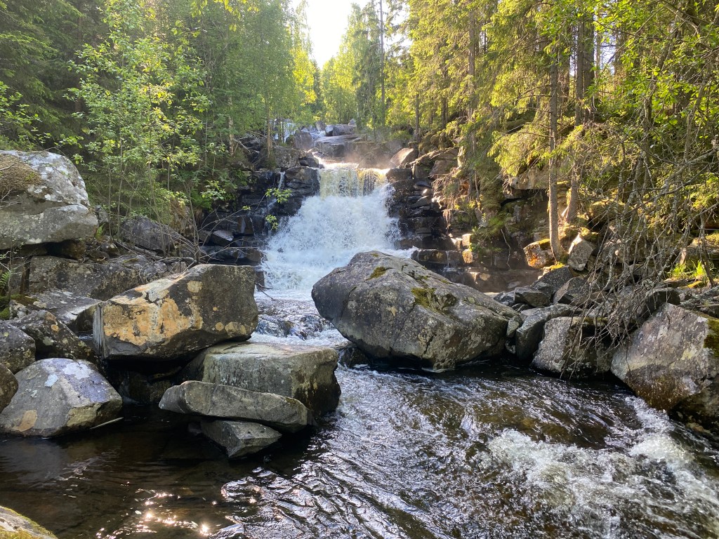
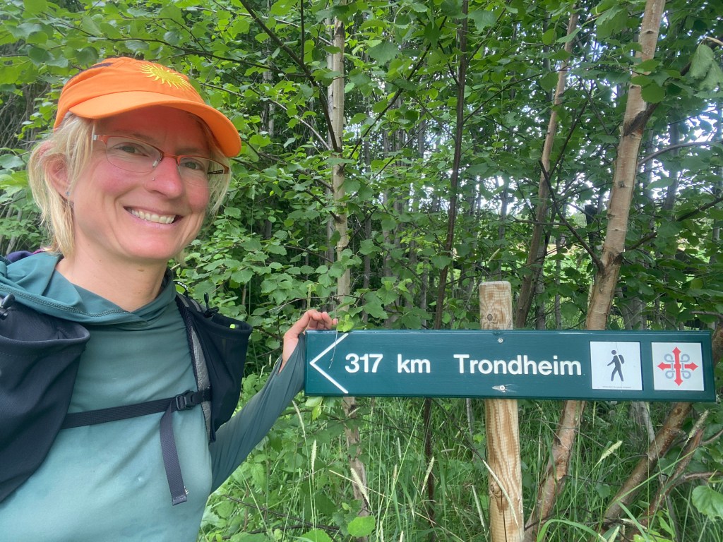
In the morning, I exchanged contact info with Jordi and Laia. We chatted, took a group photo, and hugged goodbye. Soon the forest road became a footpath named tjodvegen (ties the roads) and marked occasionally with the symbol of a pilgrim walking. The woods were gorgeous, lush, and full of morning sunshine. Shortly after crossing the river Sagåa, I took a 300 meter side trail to Kjærlighetsffossen, the waterfall of love. It did indeed seem to glow and sunlight sparkled off the water. After a time, the footpath ended at a quiet paved road, which I hiked for ~3 km, interrupted briefly by a short, well-lit tunnel.
The next section of trail was really fun! It went up and down a lot, mostly in beautiful forest, though with paved stretches that offered stellar views of the river Lågen. There were lots of stiles (wooden stairs) over fences and gated bridges that crossed wide streams cascading down the steep hillsides. I used Merlin and discovered that the bird with the ratchet-like call was a Fieldfare. Slightly before noon, I came upon a woman struggling up a climb. She was a Norwegian pilgrim, hiking a section of the trail along with three other women. I said hei (the Norwegian hello) as I passed the others at a stile.
An hour later, I encountered a local woman weed-eating a section of the path. Inside a small barn, her farm had a self-service kiosk. There were food items, drinks, an assortment of toiletries, and a cash box to deposit your payment. Though the coffee smelled good, I didn’t have the correct change in kroners. I did add the farm’s stamp to my passport. The route continued its ups and downs and I got really hungry, yet I had a destination in mind so I didn’t stop. About one kilometer away, I went the wrong way up a hill and had to backtrack. At 2:30 pm, I arrived at Stalsbergsvea, which had a small cabin that the landowners rented to pilgrims. I was interested in the water spigot, stamp, and picnic table with a view. It was a fabulous lunch location!
Full of vigor from a tasty meal and an hour long break, I hiked along back in high spirits. I put on an upbeat tune and did some dancing steps, watched by a group of brown & white cows. I tried to make friends with an adorable black cat that stalked after me for a short distance, however it ran off. Thus far, the local cats have not let me pet them; I will continue to try. The up & down, forest & road mixture continued until the river Rolla, where the path began a steep descent. About half way down, I found an appealing patch of woods and erected my tent. Following dinner, there was a light rain and for once, I went to sleep early.
Day 11
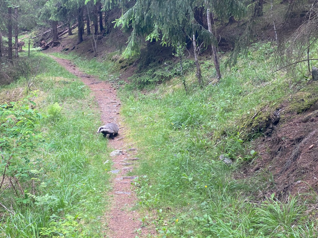
The day started with a rugged, for this trail, and un-scenic section. This included knee-high grass and thistles encroaching on a faint path plus a steep descent down a mostly denuded hillside, trail markers affixed to a couple remnant tree trunks. The trail resumed its usual condition at the Rolla Nature Reserve, where the deep gorge of the river Rolla cut through lush terrain. An informative sign told me that the reserve protected a conifer forest and its associated plant and animal life. Shortly after crossing the gorge on a gated bridge, I encountered a chunky, European Badger. I had fun watching it waddle and nose around in the grass to either side of the trail. When it caught sight of me, it did a 180 degree turn and ran away along the trail.
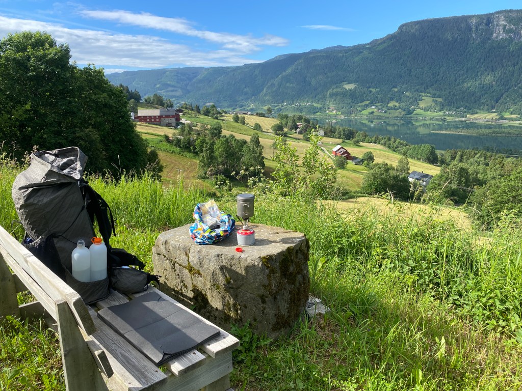
Usually I wake alert, however this morning I was groggy and kept dreaming of coffee. Finally, at 9 am, I found a perfect spot: bench, rock table, stellar view. For a premium treat, I heated water on my camp stove and made a hot coffee. I proceeded onward with renewed energy. The various roads, paved and gravel, took me past a lot of farms. It was a sunny day and many inhabitants were busy with outdoor tasks. I’d been wondering how the giant cylindrical hay bales got wrapped in plastic, then I passed a field where I observed the process! It required a tractor with a specialized attachment.
Shortly thereafter, I left the gravel road for grass footpaths that cut horizontally across hillsides. Then I wove through a neighborhood via wooden staircases and faint paths between yards. A bridge took me over the deep gorge of the river Tromsa. An hour later, I was on the king’s road and discovered a gapahuk with a marvelous view of the river Lågen. Nearby was a giant stone head – modern art without any signage – laying on its side. As I descended the hill, I caught sight of
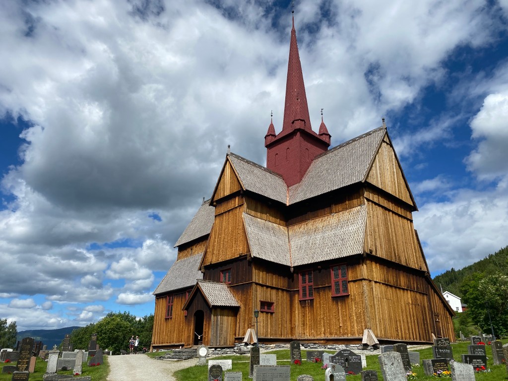
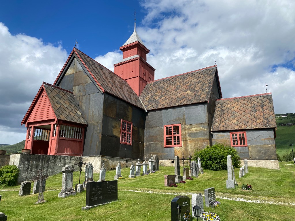
Ringbu Stave Church in the distance. I hadn’t realized I was that close and hurried there to eat lunch. The building’s post and lintel construction was very unique, a remnant of the Viking Age. Only two stave churches exist outside of Norway. I really liked the look of it. After lunch, I went inside to get a stamp and view the interior, which had a cool, carved wood chandelier.
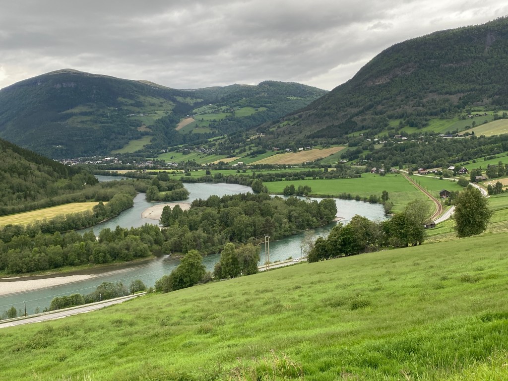
From the church, it was 45 minutes to Ringebu. While cresting a hill on a paved road, a cyclist couple came abreast and I chatted with the woman. They were from Denmark and she complained about all the hills on the route. They were on the pilgrim path to Trondheim and planned to bike back to Oslo afterwards. In Ringebu, I stopped at a grocery store. It has been such a change from typical trail life to shop every couple of days and carry out fresh foods like arugula, yogurt, and hummus. About three kilometers outside of town, the trail took a stone bridge over a deep, narrow gorge in the river Frya. The river plunged dramatically in roaring falls; the power was astounding! Directly after, I ascended into an enchanting forest and was very tempted to camp, only I wasn’t ready to stop for the day.
The path descended towards the banks of the river Lågen. For a time, it climbed again and became a grassy path above and parallel to the E6, though it eventually dropped to the roadway. I jumped the guardrail and walked with it between myself and traffic. On Hundorp’s outskirts, I stopped at the Dale-Gudbrand pilgrim center. It was closed and I found no hidden pilgrim stamp. Still, a sign declared it the historic location where Viking chief Dale Gudbrand was forcibly christianized by King Olav. This was the same King Olav who would later be buried in Trondheim and canonized as a saint, to encourage the adoption of christianity in Norway. I found myself skeptical of the guy to whose tomb I am hiking.
I hiked a paved road through Hundorp and found the neat, octagonal Sør-Fron Church. Now I was ready to be done for the day, yet unsure of opportunities in this urban area. About 300 meters shy of the river Augla, I found a dense patch of trees along the road. I climbed the steep bank and explored until I found a flat spot. It was my longest day on the trail, ~43 kilometers / 26.8 miles. The location was not ideal, due to traffic noise, however I had ear plugs. There was a malodorous smell when I removed my shoes & socks. I forgot that my feet got wet that morning, then were trapped in shoes all day. Birds sang and as I ate dinner I heard a rustling noise and briefly glimpsed the striped head of a European badger; two in one day!
Day 12
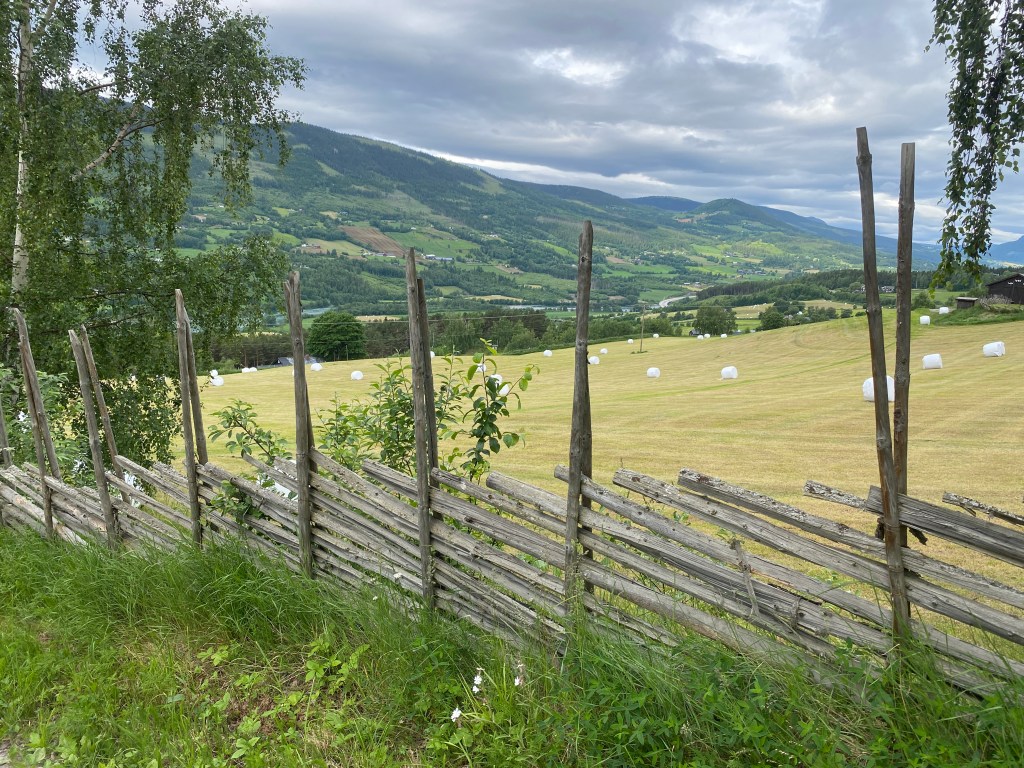
As soon as I crossed the river Augla, the path turned uphill to meander through the tidy farm Rudi. Norwegians have an interesting way of constructing fences, where tall posts support 45 degree angled slats in their lower half. Wire supports the slats at their upper end and the lower end is wedged in the ground. It appeared sturdier than an upright slat wood fence.
From Sygard Grytting, a historic pilgrim lodge, the trail climbed steadily upward. In a clear mountain stream, I washed socks & underwear and gathered water. Eventually the path turned left to cut across very steep mountain slopes. In the forest, I startled some kind of fowl with adorable baby chicks. I also found clusters of one of my favorite flowers, forget-me-nots. At a cute mountain cabin, I met a couple from the Netherlands. The woman had done the Camino Frances and was familiar with the USA long trails. When I mentioned the trails that I’d done, she said “wow, you’re a triple crowner!”. She and her husband were doing this trail’s highlights as they had a limited time. After speaking with them, the path ascended even further, around a rocky bend, and the view opened up. It was really cool to be so high above the river valley!
In the midst of the subsequent descent, I ate lunch atop a cluster of rocks. Passing through the outskirts of Vinstra, I saw a pilgrim sign and realized I was halfway to Trondheim! Wow, that went fast! In order to air my feet, a task I’d forgotten at lunch, I took an early snack break. Then I climbed into and hiked through a lovely, peaceful forest. Similar to the morning’s forest, this one perched on the side of steeply sloped terrain that plunged into the river valley. In Stø, the path began a gentle descent and passed a giant, yellow giraffe statue. There was a brief, very steep downward turn at the river Bosåa before the path joined with a quiet paved road that took a five kilometer long sweeping turn towards Kvam and offered stunning views of the river Lågen valley.
I hiked through the western edge of Kvam and crossed the river Storåa on a vehicle bridge. There was a funny section that avoided a paved road by meandering through residential backyards and employing numerous stiles to cross fences. After that, there was a brief road walk before the trail angled upward into forest. It felt like home to be back amongst the trees! I had my eye on a spot about 2.5 kilometers out of town, where the terrain lines looked flat enough to camp. Sure enough, I found a spot coated in stairstep moss and nestled amongst slender, densely packed pines.
Day 13
Not far uphill from my campsite, more than a dozen trees had fallen across the trail. I noticed a faint tread through the moss and skirted the area. Back on the trail, I found an icy cold stream from which I collected water. I’ve enjoyed these steep, forested hillsides where the streams flow from high mountain lakes or springs. In the lower sections of the trail, I avoided streams due to possible contamination from agricultural runoff. Ahead lay two ridges with a descent in between. Most of the terrain was forested with lots of moss covered rocks and soil. My guide book described the ascents as strenuous, though I found them mostly gradual. I saw only a single person, a man walking his dog.
As I hiked, I continually hoped to spot a snake, lizard, or salamander. I knew that Norway had three snake species, however, was I looking in vain for other species that did not exist? Through online research, I discovered that Norway does indeed have two lizard, two salamander, two frog, and one toad species. I memorized them all and learned their Norwegian names. Interestingly, both one lizard and one frog can freeze solid and survive thawing, a handy trait for Norway’s harsh winters.

The day’s final descent ended at a multi-use path along the E6. Eventually the path crossed under the highway and continued along the river Lågen’s edge. I enjoyed watching the water flow and eddy, though predominantly turquoise, it was many shades of blue. I took a pedestrian bridge into Otta and got groceries. The next day was a Sunday, which meant all the grocery stores would be closed. Back on the multi-use path, it soon crossed under the E6 then both turned away from the river. For 3.5 kilometers, I experienced noisy highway and was relieved to leave it behind to turn towards Sel Church. As I admired the white church set against a darkly overcast sky, a Norwegian lady noticed me and came over to chat. It turned out she and her husband host pilgrims in their home, which was a couple towns back. We chatted about the pilgrim experience. Afterwards, I added the church’s stamp to my passport and aired my feet.
Ten kilometers of flat walking – I listened to podcasts until a wind picked up and I could no longer hear them – on a gravel road beside the river brought me to Jørundgard. I peered at the reconstructed medieval farm, built as a set for the film Kristin Lavransdatter. Apparently it was based on a well-known trilogy of books by Norwegian author Sigrid Undset. The path continued 600 meters to Nord-Sel Church, where I happily discovered free camping adjacent to its parking area. There were nine or so RVs in the dirt lot. I set up my tent on flat grass between a large rock and a pine tree. Amazingly there was an open bathroom with running water and soap!
Day 14
In the morning, the Nord-Sel Church was open so I went inside. It had a simple altar, wood pews, and ample sunlight. I wrote in the guest book and stamped my passport. The path headed out of town alongside the river, first on road, then on grass. Soon it turned into a trail, full of rocks and roots, that continuously rose and fell; it was especially fun after yesterday’s flatness! When the nearby train track entered a tunnel, the trail crossed over it and began a steady, gradual ascent. I saw movement ahead of me, which it turned out was a deer, not a pilgrim.
What followed was similar terrain to the past few days: forested slopes, the river Lågen, a mix of walking surfaces. I hiked 22 kilometers and ended up in Dovre. The Dovre Church was unique, covered in flat sheets of stone. From the church, I walked another two kilometers to Toftemo Turiststasjon, which had a hotel, cabins, and camping spots. I paid for a spot plus ~$5 more for an electrical outlet (my battery packs needed charging). The young kids at the desk told me to choose any spot so I picked one on the river side, away from the road’s traffic noise. I made sure the power pedestal functioned before I set up my tent, which was trickier than usual due to wind that gusted from two directions. Happily there was WiFi signal in the grassy field and it was strong enough to download audiobooks.
I was very excited because tomorrow I would climb Dovrefjell, a scenic mountain plateau and the beginning of the trail’s remote section. The area is an important region in Norwegian folklore; the home of trolls, ghosts, and fairies. When Norway became a country in 1814, the constitution’s authors agreed to remain united Norwegians until Dovre crumbled. There’s also unique flora and fauna.

Leave a comment